Wee Waa geodata
Wee Waa (New South Wales) is a populated place; located in Australia in Australia/Sydney (GMT+11) time zone. With population of 2,072 people, there are 2846 cities with bigger population in this country. Compared to other cities in Australia, 72% of cities are located further ↓South; 56% of cities are located further ←West and 81.2% of cities have lower elevation than Wee Waa. Note1


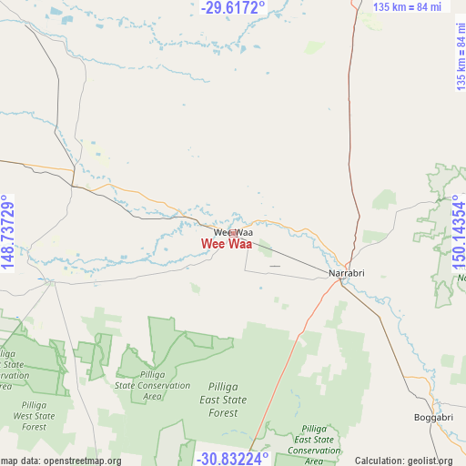
Wee Waa GPS coordinates[2]
30° 13' 35.76" South, 149° 26' 25.476" East
| Map corner | latitude | longitude |
|---|---|---|
| Upper-left | -29.6172°, | 148.73729° |
| Center: | -30.2266°, | 149.44041° |
| Lower-right: | -30.83224°, | 150.14354° |
| Map W x H: | 135.1×135.1 km | = 83.9×83.9mi |
| max Lat: | -10.58257° ⇑28% North |
| Wee Waa: | -30.2266° |
| min Lat: | ⇓72% South -43.31423° |
| min Long | Wee Waa | max Long |
| 113.53327° | 149.44041° | 153.61246° |
| W 56%⇐ | ⇒44% E |
Elevation
Elevation of Wee Waa is 194 m = 636 ft, and this is 72 m = 236 ft above average elevation for this country.
| Max E: |
1715 m = 5627 ft | 18.8% |
| Wee Waa | 194 m 636 ft | |
| Avg. | 122 m = 400 ft | |
Min E: |
-2 m = -7 ft | 81.2% |
See also: Australia elevation on elevation.city.
Geographical zone
Wee Waa is located in South temperate zone (between Tropic of Capricorn and the Antarctic Circle). Distance of this Southern Tropic circle is 755 km =469.1 mi to North.| Distance of | km | miles | from Wee Waa |
|---|---|---|---|
| Equator | 3360.9 | 2088.4 | to North |
| Tropic Capricorn | 755 | 469.1 | to North |
| Antarctic Circle | 4040.3 | 2510.5 | to South |
| South Pole | 6646.2 | 4129.8 | to South |


Nearby cities:
15 places around Wee Waa: (largest is in red/bold)
• Baradine
87.8 km =54.6 mi,  203°
203°
• Barraba
113.6 km =70.6 mi,  98°
98°
• Bingara
115.9 km =72 mi,  69°
69°
• Blair Athol
86.7 km =53.9 mi,  122°
122°
• Boggabri
78.7 km =48.9 mi,  133°
133°
• Collarenebri
112.7 km =70 mi,  312°
312°
• Coonabarabran
117.8 km =73.2 mi,  187°
187°
• Coonamble
129.1 km =80.2 mi,  231°
231°
• Curlewis
126.7 km =78.7 mi,  141°
141°
• Gunnedah
114.7 km =71.3 mi, 136°
• Manilla
135.6 km =84.3 mi, 115°
• Moree
93.3 km =58 mi,  24°
24°
• Narrabri
34.6 km =21.5 mi,  108°
108°
• Walgett
129.4 km =80.4 mi,  279°
279°
• Warialda
133.2 km =82.8 mi,  55°
55°
Sources, notices
• [Note1] Compared only with cities in Australia existing in our database
• [Src1] Map data: © OpenStreetMap contributors (CC-BY-SA)
• [Src2] Other city data from geonames.org with taken over terms of usage.
• [Src3] Geographical zone / Annual Mean Temperature by Robert A. Rohde @ Wikipedia
