Mitchell geodata
Mitchell (Queensland) is a populated place; located in Australia in Australia/Brisbane (GMT+10) time zone. With population of 1,178 people, there are 3611 cities with bigger population in this country. Compared to other cities in Australia, 87.6% of cities are located further ↓South; 50.8% of cities are located further ←West and 88.8% of cities have lower elevation than Mitchell. Note1


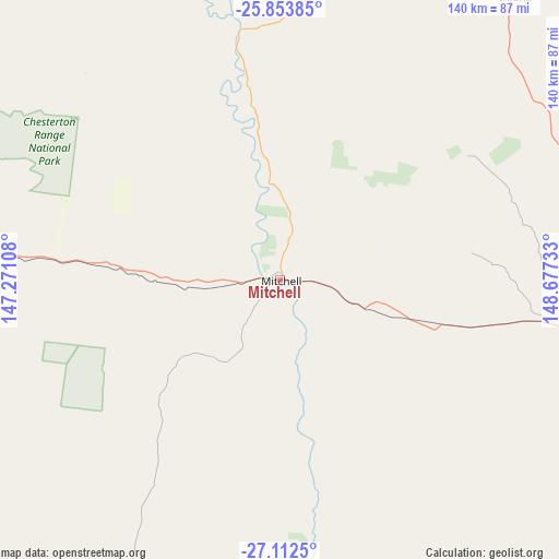
Mitchell GPS coordinates[2]
26° 29' 5.64" South, 147° 58' 27.12" East
| Map corner | latitude | longitude |
|---|---|---|
| Upper-left | -25.85385°, | 147.27108° |
| Center: | -26.4849°, | 147.9742° |
| Lower-right: | -27.1125°, | 148.67733° |
| Map W x H: | 139.9×139.9 km | = 86.9×86.9mi |
| max Lat: | -10.58257° ⇑12.4% North |
| Mitchell: | -26.4849° |
| min Lat: | ⇓87.6% South -43.31423° |
| min Long | Mitchell | max Long |
| 113.53327° | 147.9742° | 153.61246° |
| W 50.8%⇐ | ⇒49.2% E |
Elevation
Elevation of Mitchell is 340 m = 1115 ft, and this is 218 m = 715 ft above average elevation for this country.
| Max E: |
1715 m = 5627 ft | 11.2% |
| Mitchell | 340 m 1115 ft | |
| Avg. | 122 m = 400 ft | |
Min E: |
-2 m = -7 ft | 88.8% |
See also: Australia elevation on elevation.city.
Geographical zone
Mitchell is located in South temperate zone (between Tropic of Capricorn and the Antarctic Circle). Distance of this Southern Tropic circle is 338.9 km =210.6 mi to North.| Distance of | km | miles | from Mitchell |
|---|---|---|---|
| Equator | 2944.8 | 1829.8 | to North |
| Tropic Capricorn | 338.9 | 210.6 | to North |
| Antarctic Circle | 4456.3 | 2769 | to South |
| South Pole | 7062.2 | 4388.2 | to South |


Nearby cities:
15 places around Mitchell: (largest is in red/bold)
• Charleville
172.6 km =107.2 mi,  272°
272°
• Chinchilla
265.5 km =165 mi,  96°
96°
• Cunnamulla
286.7 km =178.1 mi,  232°
232°
• Dirranbandi
234.9 km =146 mi,  173°
173°
• Miles
221 km =137.3 mi, 95°
• Moura
291.9 km =181.4 mi,  43°
43°
• Mungindi
294.5 km =183 mi,  160°
160°
• Roma
81.4 km =50.6 mi, 96°
• Springsure
263.8 km =163.9 mi,  2°
2°
• St George
174.4 km =108.4 mi, 158°
• Tara
261.4 km =162.4 mi,  109°
109°
• Taroom
205.2 km =127.5 mi,  62°
62°
• Theodore
271.2 km =168.5 mi,  50°
50°
• Wandoan
202 km =125.5 mi,  78°
78°
• Westcourt
219.1 km =136.1 mi, 99°
Sources, notices
• [Note1] Compared only with cities in Australia existing in our database
• [Src1] Map data: © OpenStreetMap contributors (CC-BY-SA)
• [Src2] Other city data from geonames.org with taken over terms of usage.
• [Src3] Geographical zone / Annual Mean Temperature by Robert A. Rohde @ Wikipedia
