Moree geodata
Moree (New South Wales) is a populated place; located in Australia in Australia/Sydney (GMT+11) time zone. With population of 9,779 people, there are 619 cities with bigger population in this country. Compared to other cities in Australia, 72.8% of cities are located further ↓South; 56.7% of cities are located further ←West and 82.5% of cities have lower elevation than Moree. Note1


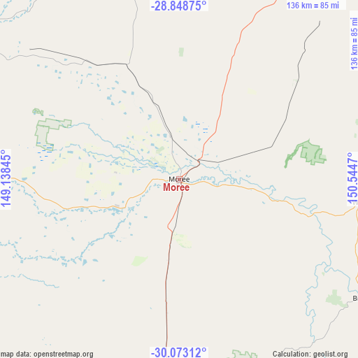
Moree GPS coordinates[2]
29° 27' 46.008" South, 149° 50' 29.652" East
| Map corner | latitude | longitude |
|---|---|---|
| Upper-left | -28.84875°, | 149.13845° |
| Center: | -29.46278°, | 149.84157° |
| Lower-right: | -30.07312°, | 150.5447° |
| Map W x H: | 136.1×136.1 km | = 84.6×84.6mi |
| max Lat: | -10.58257° ⇑27.2% North |
| Moree: | -29.46278° |
| min Lat: | ⇓72.8% South -43.31423° |
| min Long | Moree | max Long |
| 113.53327° | 149.84157° | 153.61246° |
| W 56.7%⇐ | ⇒43.3% E |
Elevation
Elevation of Moree is 212 m = 696 ft, and this is 90 m = 295 ft above average elevation for this country.
| Max E: |
1715 m = 5627 ft | 17.5% |
| Moree | 212 m 696 ft | |
| Avg. | 122 m = 400 ft | |
Min E: |
-2 m = -7 ft | 82.5% |
See also: Australia elevation on elevation.city.
Geographical zone
Moree is located in South temperate zone (between Tropic of Capricorn and the Antarctic Circle). Distance of this Southern Tropic circle is 670 km =416.3 mi to North.| Distance of | km | miles | from Moree |
|---|---|---|---|
| Equator | 3276 | 2035.6 | to North |
| Tropic Capricorn | 670 | 416.3 | to North |
| Antarctic Circle | 4125.2 | 2563.3 | to South |
| South Pole | 6731.1 | 4182.5 | to South |


Nearby cities:
15 places around Moree: (largest is in red/bold)
• Ashford
122.2 km =75.9 mi,  82°
82°
• Barraba
126.5 km =78.6 mi,  144°
144°
• Bingara
83.8 km =52.1 mi,  122°
122°
• Blair Athol
136.4 km =84.8 mi,  165°
165°
• Boggabilla
107.9 km =67 mi,  27°
27°
• Boggabri
139.9 km =86.9 mi, 172°
• Collarenebri
122.8 km =76.3 mi,  265°
265°
• Delungra
97.9 km =60.8 mi,  102°
102°
• Gilgai
130.7 km =81.2 mi,  109°
109°
• Goondiwindi
111.4 km =69.2 mi,  23°
23°
• Inverell
127.6 km =79.3 mi, 105°
• Mungindi
98.9 km =61.5 mi,  303°
303°
• Narrabri
96 km =59.7 mi,  183°
183°
• Warialda
71.6 km =44.5 mi, 97°
• Wee Waa
93.3 km =58 mi,  204°
204°
Sources, notices
• [Note1] Compared only with cities in Australia existing in our database
• [Src1] Map data: © OpenStreetMap contributors (CC-BY-SA)
• [Src2] Other city data from geonames.org with taken over terms of usage.
• [Src3] Geographical zone / Annual Mean Temperature by Robert A. Rohde @ Wikipedia
