Cunnamulla geodata
Cunnamulla (Queensland) is a populated place; located in Australia in Australia/Brisbane (GMT+10) time zone. With population of 1,235 people, there are 3536 cities with bigger population in this country. Compared to other cities in Australia, 75.6% of cities are located further ↓South; 58.7% of cities are located further →East and 81.1% of cities have lower elevation than Cunnamulla. Note1


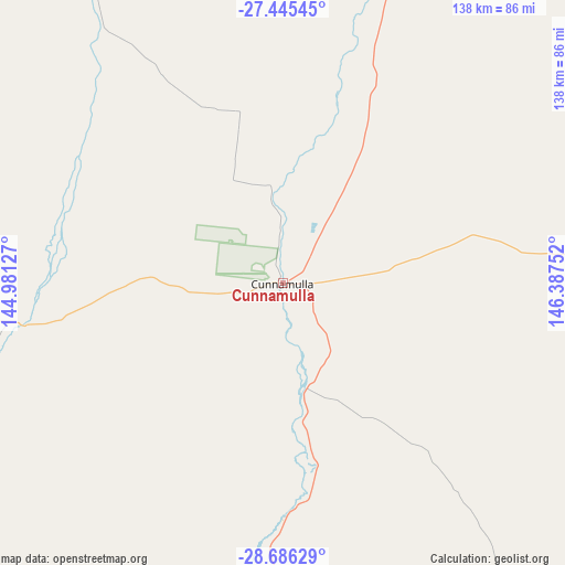
Cunnamulla GPS coordinates[2]
28° 4' 3.576" South, 145° 41' 3.804" East
| Map corner | latitude | longitude |
|---|---|---|
| Upper-left | -27.44545°, | 144.98127° |
| Center: | -28.06766°, | 145.68439° |
| Lower-right: | -28.68629°, | 146.38752° |
| Map W x H: | 138×138 km | = 85.7×85.7mi |
| max Lat: | -10.58257° ⇑24.4% North |
| Cunnamulla: | -28.06766° |
| min Lat: | ⇓75.6% South -43.31423° |
| min Long | Cunnamulla | max Long |
| 113.53327° | 145.68439° | 153.61246° |
| W 41.3%⇐ | ⇒58.7% E |
Elevation
Elevation of Cunnamulla is 193 m = 633 ft, and this is 71 m = 233 ft above average elevation for this country.
| Max E: |
1715 m = 5627 ft | 18.9% |
| Cunnamulla | 193 m 633 ft | |
| Avg. | 122 m = 400 ft | |
Min E: |
-2 m = -7 ft | 81.1% |
See also: Australia elevation on elevation.city.
Geographical zone
Cunnamulla is located in South temperate zone (between Tropic of Capricorn and the Antarctic Circle). Distance of this Southern Tropic circle is 514.9 km =319.9 mi to North.| Distance of | km | miles | from Cunnamulla |
|---|---|---|---|
| Equator | 3120.8 | 1939.2 | to North |
| Tropic Capricorn | 514.9 | 319.9 | to North |
| Antarctic Circle | 4280.3 | 2659.7 | to South |
| South Pole | 6886.2 | 4278.9 | to South |


Nearby cities:
15 places around Cunnamulla: (largest is in red/bold)
• Blackall
405.8 km =252.2 mi,  356°
356°
• Bourke
226.2 km =140.6 mi,  173°
173°
• Brewarrina
239.5 km =148.8 mi,  151°
151°
• Charleville
192.9 km =119.9 mi,  16°
16°
• Cobar
381.5 km =237.1 mi,  177°
177°
• Collarenebri
326 km =202.6 mi,  120°
120°
• Dirranbandi
255.3 km =158.6 mi,  103°
103°
• Lightning Ridge
270 km =167.8 mi, 124°
• Mitchell
286.7 km =178.1 mi,  52°
52°
• Mungindi
338.2 km =210.1 mi,  107°
107°
• North Bourke
222.2 km =138.1 mi, 173°
• Quilpie
213.7 km =132.8 mi,  319°
319°
• Roma
349 km =216.9 mi,  61°
61°
• St George
287.5 km =178.6 mi,  87°
87°
• Walgett
321.2 km =199.6 mi,  132°
132°
Sources, notices
• [Note1] Compared only with cities in Australia existing in our database
• [Src1] Map data: © OpenStreetMap contributors (CC-BY-SA)
• [Src2] Other city data from geonames.org with taken over terms of usage.
• [Src3] Geographical zone / Annual Mean Temperature by Robert A. Rohde @ Wikipedia
