Dalby geodata
Dalby (Queensland) is a populated place; located in Australia in Australia/Brisbane (GMT+10) time zone. With population of 12,650 people, there are 373 cities with bigger population in this country. Compared to other cities in Australia, 85.2% of cities are located further ↓South; 74.9% of cities are located further ←West and 88.9% of cities have lower elevation than Dalby. Note1


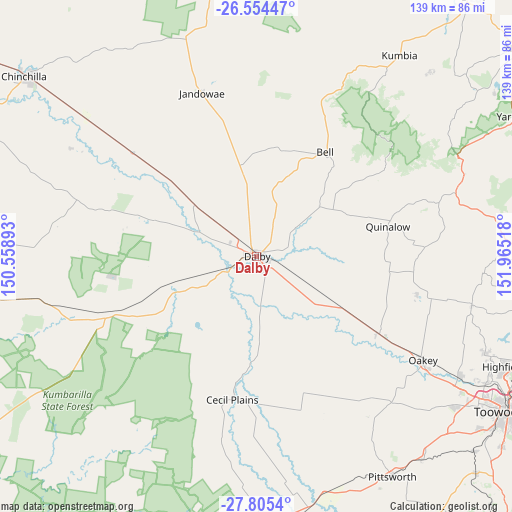
Dalby GPS coordinates[2]
27° 10' 54.084" South, 151° 15' 43.38" East
| Map corner | latitude | longitude |
|---|---|---|
| Upper-left | -26.55447°, | 150.55893° |
| Center: | -27.18169°, | 151.26205° |
| Lower-right: | -27.8054°, | 151.96518° |
| Map W x H: | 139.1×139.1 km | = 86.4×86.4mi |
| max Lat: | -10.58257° ⇑14.8% North |
| Dalby: | -27.18169° |
| min Lat: | ⇓85.2% South -43.31423° |
| min Long | Dalby | max Long |
| 113.53327° | 151.26205° | 153.61246° |
| W 74.9%⇐ | ⇒25.1% E |
Elevation
Elevation of Dalby is 343 m = 1125 ft, and this is 221 m = 725 ft above average elevation for this country.
| Max E: |
1715 m = 5627 ft | 11.1% |
| Dalby | 343 m 1125 ft | |
| Avg. | 122 m = 400 ft | |
Min E: |
-2 m = -7 ft | 88.9% |
See also: Australia elevation on elevation.city.
Geographical zone
Dalby is located in South temperate zone (between Tropic of Capricorn and the Antarctic Circle). Distance of this Southern Tropic circle is 416.4 km =258.7 mi to North.| Distance of | km | miles | from Dalby |
|---|---|---|---|
| Equator | 3022.3 | 1878 | to North |
| Tropic Capricorn | 416.4 | 258.7 | to North |
| Antarctic Circle | 4378.9 | 2720.9 | to South |
| South Pole | 6984.7 | 4340.1 | to South |


Nearby cities:
15 places around Dalby: (largest is in red/bold)
• Cotswold Hills
73.1 km =45.4 mi,  121°
121°
• Cranley
75.1 km =46.7 mi, 119°
• Glenvale
75.7 km =47 mi, 124°
• Goombungee
59.9 km =37.2 mi,  103°
103°
• Gowrie Junction
69.9 km =43.4 mi, 118°
• Highfields
75.2 km =46.7 mi,  114°
114°
• Jandowae
46.6 km =29 mi,  341°
341°
• Kingsthorpe
63.6 km =39.5 mi, 120°
• Kleinton
73.5 km =45.7 mi, 112°
• Meringandan West
67 km =41.6 mi, 112°
• Oakey
53.2 km =33.1 mi, 121°
• Pittsworth
69.9 km =43.4 mi,  148°
148°
• Southbrook
71.6 km =44.5 mi,  141°
141°
• Torrington
73.7 km =45.8 mi, 122°
• Wilsonton Heights
76.1 km =47.3 mi, 120°
Sources, notices
• [Note1] Compared only with cities in Australia existing in our database
• [Src1] Map data: © OpenStreetMap contributors (CC-BY-SA)
• [Src2] Other city data from geonames.org with taken over terms of usage.
• [Src3] Geographical zone / Annual Mean Temperature by Robert A. Rohde @ Wikipedia
