Berridale geodata
Berridale (New South Wales) is a populated place; located in Australia in Australia/Sydney (GMT+11) time zone. With population of 1,342 people, there are 3429 cities with bigger population in this country. Compared to other cities in Australia, 79.6% of cities are located further ↑North; 52.3% of cities are located further ←West and 99.2% of cities have lower elevation than Berridale. Note1


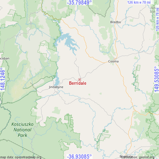
Berridale GPS coordinates[2]
36° 22' 0.228" South, 148° 49' 39.792" East
| Map corner | latitude | longitude |
|---|---|---|
| Upper-left | -35.79849°, | 148.1246° |
| Center: | -36.36673°, | 148.82772° |
| Lower-right: | -36.93085°, | 149.53085° |
| Map W x H: | 125.9×125.9 km | = 78.2×78.2mi |
| max Lat: | -10.58257° ⇑79.6% North |
| Berridale: | -36.36673° |
| min Lat: | ⇓20.4% South -43.31423° |
| min Long | Berridale | max Long |
| 113.53327° | 148.82772° | 153.61246° |
| W 52.3%⇐ | ⇒47.7% E |
Elevation
Elevation of Berridale is 862 m = 2828 ft, and this is 740 m = 2428 ft above average elevation for this country.
| Max E: |
1715 m = 5627 ft | 0.8% |
| Berridale | 862 m 2828 ft | |
| Avg. | 122 m = 400 ft | |
Min E: |
-2 m = -7 ft | 99.2% |
See also: Australia elevation on elevation.city.
Geographical zone
Berridale is located in South temperate zone (between Tropic of Capricorn and the Antarctic Circle). Distance of this Southern Tropic circle is 1437.7 km =893.3 mi to North.| Distance of | km | miles | from Berridale |
|---|---|---|---|
| Equator | 4043.6 | 2512.6 | to North |
| Tropic Capricorn | 1437.7 | 893.3 | to North |
| Antarctic Circle | 3357.6 | 2086.3 | to South |
| South Pole | 5963.5 | 3705.5 | to South |


Nearby cities:
15 places around Berridale: (largest is in red/bold)
• Bega
96.8 km =60.1 mi,  110°
110°
• Bemboka
72.6 km =45.1 mi, 113°
• Bombala
70.8 km =44 mi,  148°
148°
• Burra
96.6 km =60 mi,  21°
21°
• Candelo
89.3 km =55.5 mi,  119°
119°
• Cobargo
94.8 km =58.9 mi,  91°
91°
• Cooma
30.3 km =18.8 mi,  61°
61°
• Corryong
85 km =52.8 mi,  282°
282°
• Crackenback
30.5 km =19 mi,  253°
253°
• East Jindabyne
16.1 km =10 mi,  258°
258°
• Jindabyne
19.2 km =11.9 mi, 252°
• Kosciuszko National Park
33 km =20.5 mi,  290°
290°
• Michelago
78.4 km =48.7 mi, 22°
• Moonbah
27.9 km =17.3 mi,  242°
242°
• Tumbarumba
98.3 km =61.1 mi,  311°
311°
Sources, notices
• [Note1] Compared only with cities in Australia existing in our database
• [Src1] Map data: © OpenStreetMap contributors (CC-BY-SA)
• [Src2] Other city data from geonames.org with taken over terms of usage.
• [Src3] Geographical zone / Annual Mean Temperature by Robert A. Rohde @ Wikipedia
