Crackenback geodata
Crackenback (New South Wales) is a section of populated place; located in Australia in Australia/Sydney (GMT+11) time zone. With population of 741 people, there are 4260 cities with bigger population in this country. Compared to other cities in Australia, 79.9% of cities are located further ↑North; 51.7% of cities are located further ←West and 99.9% of cities have lower elevation than Crackenback. Note1


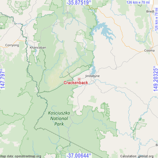
Crackenback GPS coordinates[2]
36° 26' 34.368" South, 148° 30' 0.432" East
| Map corner | latitude | longitude |
|---|---|---|
| Upper-left | -35.87519°, | 147.797° |
| Center: | -36.44288°, | 148.50012° |
| Lower-right: | -37.00644°, | 149.20325° |
| Map W x H: | 125.8×125.8 km | = 78.2×78.2mi |
| max Lat: | -10.58257° ⇑79.9% North |
| Crackenback: | -36.44288° |
| min Lat: | ⇓20.1% South -43.31423° |
| min Long | Crackenback | max Long |
| 113.53327° | 148.50012° | 153.61246° |
| W 51.7%⇐ | ⇒48.3% E |
Elevation
Elevation of Crackenback is 1111 m = 3645 ft, and this is 989 m = 3245 ft above average elevation for this country.
| Max E: |
1715 m = 5627 ft | 0.099999999999994% |
| Crackenback | 1111 m 3645 ft | |
| Avg. | 122 m = 400 ft | |
Min E: |
-2 m = -7 ft | 99.9% |
See also: Australia elevation on elevation.city.
Geographical zone
Crackenback is located in South temperate zone (between Tropic of Capricorn and the Antarctic Circle). Distance of this Southern Tropic circle is 1446.1 km =898.6 mi to North.| Distance of | km | miles | from Crackenback |
|---|---|---|---|
| Equator | 4052.1 | 2517.9 | to North |
| Tropic Capricorn | 1446.1 | 898.6 | to North |
| Antarctic Circle | 3349.1 | 2081 | to South |
| South Pole | 5955 | 3700.3 | to South |


Nearby cities:
15 places around Crackenback: (largest is in red/bold)
• Batlow
107.4 km =66.7 mi,  342°
342°
• Bemboka
98 km =60.9 mi,  102°
102°
• Berridale
30.5 km =19 mi,  73°
73°
• Bombala
83.9 km =52.1 mi,  128°
128°
• Burra
117.8 km =73.2 mi,  33°
33°
• Candelo
112.6 km =70 mi,  108°
108°
• Cooma
60.5 km =37.6 mi, 67°
• Corryong
60.1 km =37.3 mi,  297°
297°
• East Jindabyne
14.5 km =9 mi, 68°
• Jindabyne
11.3 km =7 mi,  75°
75°
• Kosciuszko National Park
19.9 km =12.4 mi,  355°
355°
• Michelago
100.5 km =62.4 mi,  36°
36°
• Moonbah
6.3 km =3.9 mi, 133°
• Royalla
118.4 km =73.6 mi, 29°
• Tumbarumba
86 km =53.4 mi,  329°
329°
Sources, notices
• [Note1] Compared only with cities in Australia existing in our database
• [Src1] Map data: © OpenStreetMap contributors (CC-BY-SA)
• [Src2] Other city data from geonames.org with taken over terms of usage.
• [Src3] Geographical zone / Annual Mean Temperature by Robert A. Rohde @ Wikipedia
