Hermannsburg geodata
Hermannsburg (Northern Territory) is a populated place; located in Australia in Australia/Darwin (GMT+9.5) time zone. With population of 619 people, there are 4517 cities with bigger population in this country. Compared to other cities in Australia, 90.7% of cities are located further ↓South; 86.9% of cities are located further →East and 94.5% of cities have lower elevation than Hermannsburg. Note1


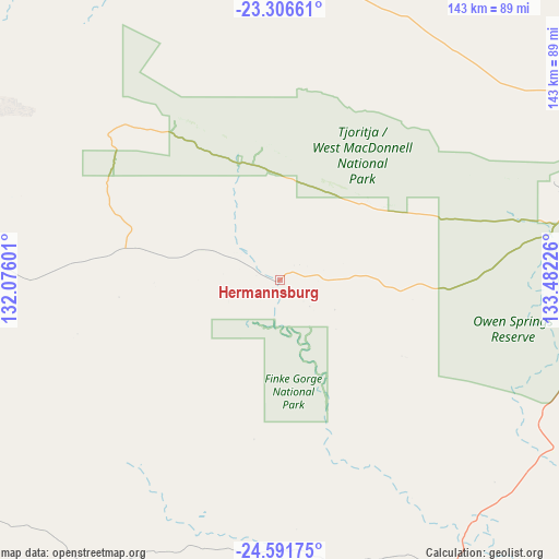
Hermannsburg GPS coordinates[2]
23° 57' 2.808" South, 132° 46' 44.868" East
| Map corner | latitude | longitude |
|---|---|---|
| Upper-left | -23.30661°, | 132.07601° |
| Center: | -23.95078°, | 132.77913° |
| Lower-right: | -24.59175°, | 133.48226° |
| Map W x H: | 142.9×142.9 km | = 88.8×88.8mi |
| max Lat: | -10.58257° ⇑9.3% North |
| Hermannsburg: | -23.95078° |
| min Lat: | ⇓90.7% South -43.31423° |
| min Long | Hermannsburg | max Long |
| 113.53327° | 132.77913° | 153.61246° |
| W 13.1%⇐ | ⇒86.9% E |
Elevation
Elevation of Hermannsburg is 568 m = 1864 ft, and this is 446 m = 1463 ft above average elevation for this country.
| Max E: |
1715 m = 5627 ft | 5.5% |
| Hermannsburg | 568 m 1864 ft | |
| Avg. | 122 m = 400 ft | |
Min E: |
-2 m = -7 ft | 94.5% |
See also: Australia elevation on elevation.city.
Geographical zone
Hermannsburg is located in South temperate zone (between Tropic of Capricorn and the Antarctic Circle). Distance of this Southern Tropic circle is 57.2 km =35.5 mi to North.| Distance of | km | miles | from Hermannsburg |
|---|---|---|---|
| Equator | 2663.1 | 1654.8 | to North |
| Tropic Capricorn | 57.2 | 35.5 | to North |
| Antarctic Circle | 4738.1 | 2944.1 | to South |
| South Pole | 7344 | 4563.3 | to South |


Nearby cities:
15 places around Hermannsburg: (largest is in red/bold)
• Alice Springs
115.8 km =72 mi,  75°
75°
• Alice Springs city centre
115.6 km =71.8 mi, 75°
• Araluen
112.9 km =70.2 mi, 75°
• Braitling
114.9 km =71.4 mi,  74°
74°
• Desert Springs
115.7 km =71.9 mi, 76°
• East Side
116.9 km =72.6 mi, 75°
• Gillen
113.8 km =70.7 mi, 76°
• Hugh
88.1 km =54.7 mi,  115°
115°
• Ilparpa
107.9 km =67 mi, 78°
• Larapinta
110.8 km =68.8 mi, 75°
• Mount Johns
118.1 km =73.4 mi, 77°
• Petermann
133.4 km =82.9 mi,  253°
253°
• Ross
116.6 km =72.5 mi, 78°
• Sadadeen
117.3 km =72.9 mi, 76°
• The Gap
114.4 km =71.1 mi, 76°
Sources, notices
• [Note1] Compared only with cities in Australia existing in our database
• [Src1] Map data: © OpenStreetMap contributors (CC-BY-SA)
• [Src2] Other city data from geonames.org with taken over terms of usage.
• [Src3] Geographical zone / Annual Mean Temperature by Robert A. Rohde @ Wikipedia
