Alice Springs city centre geodata
Alice Springs city centre (Northern Territory) is a section of populated place; located in Australia in Australia/Darwin (GMT+9.5) time zone. With population of 639 people, there are 4475 cities with bigger population in this country. Compared to other cities in Australia, 91.3% of cities are located further ↓South; 86.6% of cities are located further →East and 95% of cities have lower elevation than Alice Springs city centre. Note1
Current local time in Alice Springs city centre:
11:35 AM, ThursdayDifference from your time zone: hours


Alice Springs city centre GPS coordinates[2]
23° 41' 49.092" South, 133° 52' 54.336" East
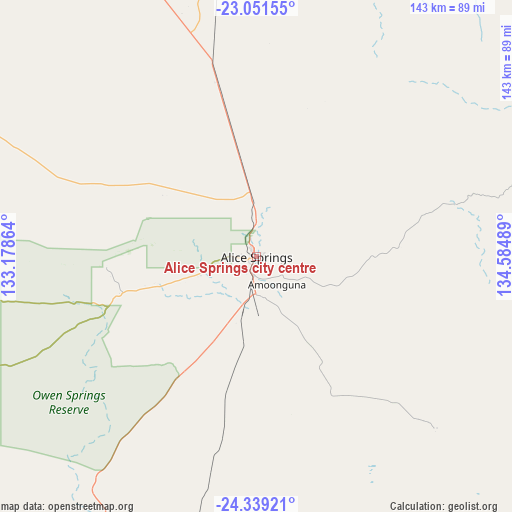
| Map corner | latitude | longitude |
|---|---|---|
| Upper-left | -23.05155°, | 133.17864° |
| Center: | -23.69697°, | 133.88176° |
| Lower-right: | -24.33921°, | 134.58489° |
| Map W x H: | 143.2×143.2 km | = 89×89mi |
| max Lat: | -10.58257° ⇑8.7% North |
| Alice Springs city centre: | -23.69697° |
| min Lat: | ⇓91.3% South -43.31423° |
| min Long | Alice Springs c | max Long |
| 113.53327° | 133.88176° | 153.61246° |
| W 13.4%⇐ | ⇒86.6% E |
Elevation
Elevation of Alice Springs city centre is 582 m = 1909 ft, and this is 460 m = 1509 ft above average elevation for this country.
| Max E: |
1715 m = 5627 ft | 5% |
| Alice Springs city centre | 582 m 1909 ft | |
| Avg. | 122 m = 400 ft | |
Min E: |
-2 m = -7 ft | 95% |
See also: Australia elevation on elevation.city.
Geographical zone
Alice Springs city centre is located in South temperate zone (between Tropic of Capricorn and the Antarctic Circle). Distance of this Southern Tropic circle is 28.9 km =18 mi to North.| Distance of | km | miles | from Alice Springs city centre |
|---|---|---|---|
| Equator | 2634.9 | 1637.3 | to North |
| Tropic Capricorn | 28.9 | 18 | to North |
| Antarctic Circle | 4766.3 | 2961.6 | to South |
| South Pole | 7372.2 | 4580.9 | to South |


Nearby cities:
15 places around Alice Springs city centre: (largest is in red/bold)
• Alice Springs
0.2 km =0.1 mi,  106°
106°
• Araluen
2.8 km =1.7 mi,  272°
272°
• Braitling
2.3 km =1.4 mi,  324°
324°
• Desert Springs
2.2 km =1.4 mi,  163°
163°
• East Side
1.3 km =0.8 mi,  64°
64°
• Gillen
2.1 km =1.3 mi,  229°
229°
• Hermannsburg
115.6 km =71.8 mi,  255°
255°
• Hugh
74 km =46 mi,  206°
206°
• Ilparpa
9 km =5.6 mi, 226°
• Larapinta
5.1 km =3.2 mi, 274°
• Mount Johns
4.3 km =2.7 mi,  132°
132°
• Ross
5.7 km =3.5 mi, 157°
• Sadadeen
2.1 km =1.3 mi, 112°
• Santa Teresa
69.4 km =43.1 mi, 133°
• The Gap
2 km =1.2 mi,  203°
203°
Sources, notices
• [Note1] Compared only with cities in Australia existing in our database
• [Src1] Map data: © OpenStreetMap contributors (CC-BY-SA)
• [Src2] Other city data from geonames.org with taken over terms of usage.
• [Src3] Geographical zone / Annual Mean Temperature by Robert A. Rohde @ Wikipedia
