Sadadeen geodata
Sadadeen (Northern Territory) is a section of populated place; located in Australia in Australia/Darwin (GMT+9.5) time zone. With population of 2,101 people, there are 2827 cities with bigger population in this country. Compared to other cities in Australia, 91.2% of cities are located further ↓South; 86.5% of cities are located further →East and 95% of cities have lower elevation than Sadadeen. Note1


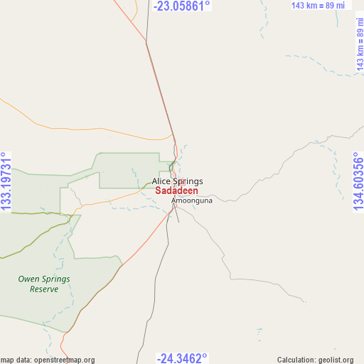
Sadadeen GPS coordinates[2]
23° 42' 14.364" South, 133° 54' 1.548" East
| Map corner | latitude | longitude |
|---|---|---|
| Upper-left | -23.05861°, | 133.19731° |
| Center: | -23.70399°, | 133.90043° |
| Lower-right: | -24.3462°, | 134.60356° |
| Map W x H: | 143.2×143.2 km | = 89×89mi |
| max Lat: | -10.58257° ⇑8.8% North |
| Sadadeen: | -23.70399° |
| min Lat: | ⇓91.2% South -43.31423° |
| min Long | Sadadeen | max Long |
| 113.53327° | 133.90043° | 153.61246° |
| W 13.5%⇐ | ⇒86.5% E |
Elevation
Elevation of Sadadeen is 582 m = 1909 ft, and this is 460 m = 1509 ft above average elevation for this country.
| Max E: |
1715 m = 5627 ft | 5% |
| Sadadeen | 582 m 1909 ft | |
| Avg. | 122 m = 400 ft | |
Min E: |
-2 m = -7 ft | 95% |
See also: Australia elevation on elevation.city.
Geographical zone
Sadadeen is located in South temperate zone (between Tropic of Capricorn and the Antarctic Circle). Distance of this Southern Tropic circle is 29.7 km =18.5 mi to North.| Distance of | km | miles | from Sadadeen |
|---|---|---|---|
| Equator | 2635.6 | 1637.7 | to North |
| Tropic Capricorn | 29.7 | 18.5 | to North |
| Antarctic Circle | 4765.5 | 2961.1 | to South |
| South Pole | 7371.4 | 4580.4 | to South |


Nearby cities:
15 places around Sadadeen: (largest is in red/bold)
• Alice Springs
1.9 km =1.2 mi,  292°
292°
• Alice Springs city centre
2.1 km =1.3 mi, 292°
• Araluen
4.8 km =3 mi,  280°
280°
• Braitling
4.2 km =2.6 mi,  309°
309°
• Desert Springs
1.8 km =1.1 mi,  225°
225°
• East Side
1.5 km =0.9 mi,  331°
331°
• Gillen
3.6 km =2.2 mi,  260°
260°
• Hermannsburg
117.3 km =72.9 mi, 256°
• Hugh
74.1 km =46 mi,  207°
207°
• Ilparpa
10 km =6.2 mi,  237°
237°
• Larapinta
7.1 km =4.4 mi, 279°
• Mount Johns
2.5 km =1.6 mi,  149°
149°
• Ross
4.5 km =2.8 mi,  175°
175°
• Santa Teresa
67.5 km =41.9 mi,  134°
134°
• The Gap
2.9 km =1.8 mi,  248°
248°
Sources, notices
• [Note1] Compared only with cities in Australia existing in our database
• [Src1] Map data: © OpenStreetMap contributors (CC-BY-SA)
• [Src2] Other city data from geonames.org with taken over terms of usage.
• [Src3] Geographical zone / Annual Mean Temperature by Robert A. Rohde @ Wikipedia
