Petermann geodata
Petermann (Northern Territory) is a populated place; located in Australia in Australia/Darwin (GMT+9.5) time zone. With population of 522 people, there are 4810 cities with bigger population in this country. Compared to other cities in Australia, 90.6% of cities are located further ↓South; 87.1% of cities are located further →East and 96.1% of cities have lower elevation than Petermann. Note1


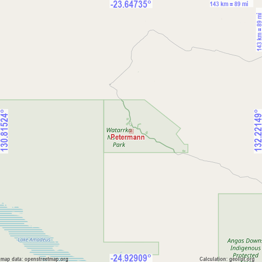
Petermann GPS coordinates[2]
24° 17' 23.424" South, 131° 31' 6.096" East
| Map corner | latitude | longitude |
|---|---|---|
| Upper-left | -23.64735°, | 130.81524° |
| Center: | -24.28984°, | 131.51836° |
| Lower-right: | -24.92909°, | 132.22149° |
| Map W x H: | 142.5×142.5 km | = 88.5×88.5mi |
| max Lat: | -10.58257° ⇑9.4% North |
| Petermann: | -24.28984° |
| min Lat: | ⇓90.6% South -43.31423° |
| min Long | Petermann | max Long |
| 113.53327° | 131.51836° | 153.61246° |
| W 12.9%⇐ | ⇒87.1% E |
Elevation
Elevation of Petermann is 607 m = 1991 ft, and this is 485 m = 1591 ft above average elevation for this country.
| Max E: |
1715 m = 5627 ft | 3.9% |
| Petermann | 607 m 1991 ft | |
| Avg. | 122 m = 400 ft | |
Min E: |
-2 m = -7 ft | 96.1% |
See also: Australia elevation on elevation.city.
Geographical zone
Petermann is located in South temperate zone (between Tropic of Capricorn and the Antarctic Circle). Distance of this Southern Tropic circle is 94.9 km =59 mi to North.| Distance of | km | miles | from Petermann |
|---|---|---|---|
| Equator | 2700.8 | 1678.2 | to North |
| Tropic Capricorn | 94.9 | 59 | to North |
| Antarctic Circle | 4700.4 | 2920.7 | to South |
| South Pole | 7306.3 | 4539.9 | to South |


Nearby cities:
15 places around Petermann: (largest is in red/bold)
• Alice Springs
249.1 km =154.8 mi,  74°
74°
• Alice Springs city centre
249 km =154.7 mi, 74°
• Araluen
246.3 km =153 mi, 74°
• Braitling
248.2 km =154.2 mi, 74°
• Desert Springs
249 km =154.7 mi,  75°
75°
• Gillen
247 km =153.5 mi, 74°
• Hermannsburg
133.4 km =82.9 mi, 73°
• Hugh
207 km =128.6 mi,  90°
90°
• Ilparpa
241.1 km =149.8 mi, 75°
• Larapinta
244.2 km =151.7 mi, 74°
• Pukatja
229.6 km =142.7 mi,  164°
164°
• Ross
249.7 km =155.2 mi, 75°
• The Gap
247.7 km =153.9 mi, 75°
• Yuendumu
227.9 km =141.6 mi,  7°
7°
• Yulara
118.5 km =73.6 mi,  206°
206°
Sources, notices
• [Note1] Compared only with cities in Australia existing in our database
• [Src1] Map data: © OpenStreetMap contributors (CC-BY-SA)
• [Src2] Other city data from geonames.org with taken over terms of usage.
• [Src3] Geographical zone / Annual Mean Temperature by Robert A. Rohde @ Wikipedia
