Hugh geodata
Hugh (Northern Territory) is a populated locality; located in Australia in Australia/Darwin (GMT+9.5) time zone. With population of 926 people, there are 3937 cities with bigger population in this country. Compared to other cities in Australia, 90.6% of cities are located further ↓South; 86.8% of cities are located further →East and 94.1% of cities have lower elevation than Hugh. Note1


Hugh GPS coordinates[2]
24° 17' 38.868" South, 133° 33' 40.5" East
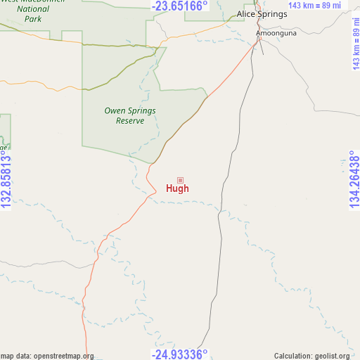
| Map corner | latitude | longitude |
|---|---|---|
| Upper-left | -23.65166°, | 132.85813° |
| Center: | -24.29413°, | 133.56125° |
| Lower-right: | -24.93336°, | 134.26438° |
| Map W x H: | 142.5×142.5 km | = 88.5×88.5mi |
| max Lat: | -10.58257° ⇑9.4% North |
| Hugh: | -24.29413° |
| min Lat: | ⇓90.6% South -43.31423° |
| min Long | Hugh | max Long |
| 113.53327° | 133.56125° | 153.61246° |
| W 13.2%⇐ | ⇒86.8% E |
Elevation
Elevation of Hugh is 549 m = 1801 ft, and this is 427 m = 1401 ft above average elevation for this country.
| Max E: |
1715 m = 5627 ft | 5.9% |
| Hugh | 549 m 1801 ft | |
| Avg. | 122 m = 400 ft | |
Min E: |
-2 m = -7 ft | 94.1% |
See also: Australia elevation on elevation.city.
Geographical zone
Hugh is located in South temperate zone (between Tropic of Capricorn and the Antarctic Circle). Distance of this Southern Tropic circle is 95.3 km =59.2 mi to North.| Distance of | km | miles | from Hugh |
|---|---|---|---|
| Equator | 2701.3 | 1678.5 | to North |
| Tropic Capricorn | 95.3 | 59.2 | to North |
| Antarctic Circle | 4699.9 | 2920.4 | to South |
| South Pole | 7305.8 | 4539.6 | to South |


Nearby cities:
15 places around Hugh: (largest is in red/bold)
• Alice Springs
74 km =46 mi,  26°
26°
• Alice Springs city centre
74 km =46 mi, 26°
• Araluen
72.9 km =45.3 mi,  24°
24°
• Braitling
75.1 km =46.7 mi, 24°
• Desert Springs
72.4 km =45 mi, 27°
• East Side
75 km =46.6 mi, 26°
• Gillen
72 km =44.7 mi, 25°
• Hermannsburg
88.1 km =54.7 mi,  295°
295°
• Ilparpa
65.6 km =40.8 mi, 23°
• Larapinta
72.2 km =44.9 mi, 22°
• Mount Johns
72.8 km =45.2 mi, 29°
• Ross
70.3 km =43.7 mi, 29°
• Sadadeen
74.1 km =46 mi, 27°
• Santa Teresa
84.3 km =52.4 mi,  77°
77°
• The Gap
72 km =44.7 mi, 26°
Sources, notices
• [Note1] Compared only with cities in Australia existing in our database
• [Src1] Map data: © OpenStreetMap contributors (CC-BY-SA)
• [Src2] Other city data from geonames.org with taken over terms of usage.
• [Src3] Geographical zone / Annual Mean Temperature by Robert A. Rohde @ Wikipedia
