Braitling geodata
Braitling (Northern Territory) is a section of populated place; located in Australia in Australia/Darwin (GMT+9.5) time zone. With population of 3,023 people, there are 2242 cities with bigger population in this country. Compared to other cities in Australia, 91.4% of cities are located further ↓South; 86.7% of cities are located further →East and 95.3% of cities have lower elevation than Braitling. Note1


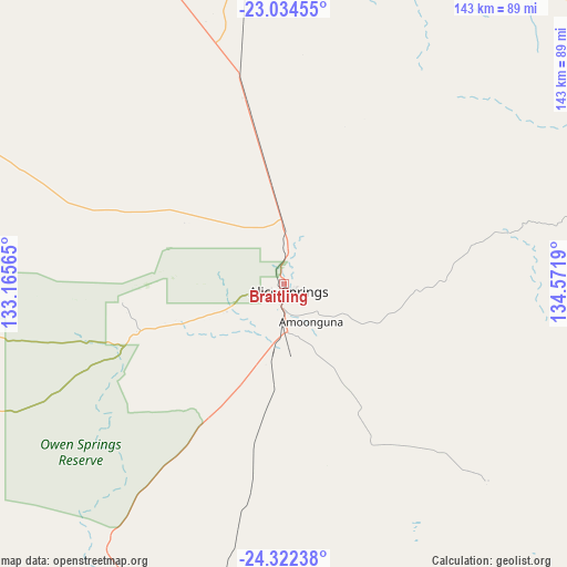
Braitling GPS coordinates[2]
23° 40' 48.18" South, 133° 52' 7.572" East
| Map corner | latitude | longitude |
|---|---|---|
| Upper-left | -23.03455°, | 133.16565° |
| Center: | -23.68005°, | 133.86877° |
| Lower-right: | -24.32238°, | 134.5719° |
| Map W x H: | 143.2×143.2 km | = 89×89mi |
| max Lat: | -10.58257° ⇑8.6% North |
| Braitling: | -23.68005° |
| min Lat: | ⇓91.4% South -43.31423° |
| min Long | Braitling | max Long |
| 113.53327° | 133.86877° | 153.61246° |
| W 13.3%⇐ | ⇒86.7% E |
Elevation
Elevation of Braitling is 587 m = 1926 ft, and this is 465 m = 1526 ft above average elevation for this country.
| Max E: |
1715 m = 5627 ft | 4.7% |
| Braitling | 587 m 1926 ft | |
| Avg. | 122 m = 400 ft | |
Min E: |
-2 m = -7 ft | 95.3% |
See also: Australia elevation on elevation.city.
Geographical zone
Braitling is located in South temperate zone (between Tropic of Capricorn and the Antarctic Circle). Distance of this Southern Tropic circle is 27.1 km =16.8 mi to North.| Distance of | km | miles | from Braitling |
|---|---|---|---|
| Equator | 2633 | 1636.1 | to North |
| Tropic Capricorn | 27.1 | 16.8 | to North |
| Antarctic Circle | 4768.2 | 2962.8 | to South |
| South Pole | 7374.1 | 4582.1 | to South |


Nearby cities:
15 places around Braitling: (largest is in red/bold)
• Alice Springs
2.5 km =1.6 mi,  142°
142°
• Alice Springs city centre
2.3 km =1.4 mi, 144°
• Araluen
2.3 km =1.4 mi,  220°
220°
• Desert Springs
4.4 km =2.7 mi,  153°
153°
• East Side
2.8 km =1.7 mi,  118°
118°
• Gillen
3.2 km =2 mi,  185°
185°
• Hermannsburg
114.9 km =71.4 mi,  254°
254°
• Hugh
75.1 km =46.7 mi,  204°
204°
• Ilparpa
9.6 km =6 mi,  212°
212°
• Larapinta
4.1 km =2.5 mi, 249°
• Mount Johns
6.6 km =4.1 mi, 136°
• Ross
8 km =5 mi, 153°
• Sadadeen
4.2 km =2.6 mi,  129°
129°
• Santa Teresa
71.7 km =44.6 mi, 134°
• The Gap
3.7 km =2.3 mi,  172°
172°
Sources, notices
• [Note1] Compared only with cities in Australia existing in our database
• [Src1] Map data: © OpenStreetMap contributors (CC-BY-SA)
• [Src2] Other city data from geonames.org with taken over terms of usage.
• [Src3] Geographical zone / Annual Mean Temperature by Robert A. Rohde @ Wikipedia
