Sandover geodata
Sandover (Northern Territory) is a section of populated place; located in Australia in Australia/Darwin (GMT+9.5) time zone. With population of 653 people, there are 4428 cities with bigger population in this country. Compared to other cities in Australia, 92.6% of cities are located further ↓South; 86.2% of cities are located further →East and 90.2% of cities have lower elevation than Sandover. Note1


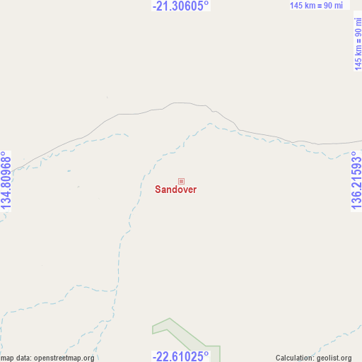
Sandover GPS coordinates[2]
21° 57' 34.74" South, 135° 30' 46.08" East
| Map corner | latitude | longitude |
|---|---|---|
| Upper-left | -21.30605°, | 134.80968° |
| Center: | -21.95965°, | 135.5128° |
| Lower-right: | -22.61025°, | 136.21593° |
| Map W x H: | 145×145 km | = 90.1×90.1mi |
| max Lat: | -10.58257° ⇑7.4% North |
| Sandover: | -21.95965° |
| min Lat: | ⇓92.6% South -43.31423° |
| min Long | Sandover | max Long |
| 113.53327° | 135.5128° | 153.61246° |
| W 13.8%⇐ | ⇒86.2% E |
Elevation
Elevation of Sandover is 382 m = 1253 ft, and this is 260 m = 853 ft above average elevation for this country.
| Max E: |
1715 m = 5627 ft | 9.8% |
| Sandover | 382 m 1253 ft | |
| Avg. | 122 m = 400 ft | |
Min E: |
-2 m = -7 ft | 90.2% |
See also: Australia elevation on elevation.city.
Geographical zone
Sandover is located in South Torrid zone (between Equator and Tropic of Capricorn). Distance of this Southern Tropic circle is 164.2 km =102 mi to South.| Distance of | km | miles | from Sandover |
|---|---|---|---|
| Equator | 2441.7 | 1517.2 | to North |
| Tropic Capricorn | 164.2 | 102 | to South |
| Antarctic Circle | 4959.5 | 3081.7 | to South |
| South Pole | 7565.4 | 4700.9 | to South |


Nearby cities:
15 places around Sandover: (largest is in red/bold)
• Alice Springs
255.4 km =158.7 mi,  220°
220°
• Alice Springs city centre
255.4 km =158.7 mi, 220°
• Anmatjere
218.5 km =135.8 mi,  261°
261°
• Araluen
257.2 km =159.8 mi, 221°
• Braitling
254.9 km =158.4 mi, 221°
• Desert Springs
256.6 km =159.4 mi, 220°
• East Side
254.3 km =158 mi, 220°
• Gillen
257.5 km =160 mi, 220°
• Ilparpa
264.4 km =164.3 mi, 221°
• Larapinta
258.5 km =160.6 mi, 221°
• Mount Johns
255.6 km =158.8 mi, 219°
• Ross
258 km =160.3 mi, 219°
• Sadadeen
254.8 km =158.3 mi, 220°
• Santa Teresa
268.1 km =166.6 mi,  205°
205°
• The Gap
257.3 km =159.9 mi, 220°
Sources, notices
• [Note1] Compared only with cities in Australia existing in our database
• [Src1] Map data: © OpenStreetMap contributors (CC-BY-SA)
• [Src2] Other city data from geonames.org with taken over terms of usage.
• [Src3] Geographical zone / Annual Mean Temperature by Robert A. Rohde @ Wikipedia
