New Gisborne geodata
New Gisborne (Victoria) is a populated place; located in Australia in Australia/Melbourne (GMT+11) time zone. With population of 2,334 people, there are 2669 cities with bigger population in this country. Compared to other cities in Australia, 82.4% of cities are located further ↑North; 69.8% of cities are located further →East and 93% of cities have lower elevation than New Gisborne. Note1


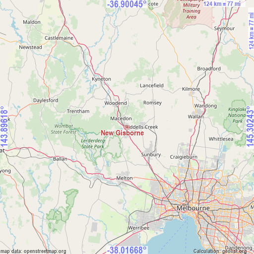
New Gisborne GPS coordinates[2]
37° 27' 38.34" South, 144° 35' 57.48" East
| Map corner | latitude | longitude |
|---|---|---|
| Upper-left | -36.90045°, | 143.89618° |
| Center: | -37.46065°, | 144.5993° |
| Lower-right: | -38.01668°, | 145.30243° |
| Map W x H: | 124.1×124.1 km | = 77.1×77.1mi |
| max Lat: | -10.58257° ⇑82.4% North |
| New Gisborne: | -37.46065° |
| min Lat: | ⇓17.6% South -43.31423° |
| min Long | New Gisborne | max Long |
| 113.53327° | 144.5993° | 153.61246° |
| W 30.2%⇐ | ⇒69.8% E |
Elevation
Elevation of New Gisborne is 470 m = 1542 ft, and this is 348 m = 1142 ft above average elevation for this country.
| Max E: |
1715 m = 5627 ft | 7% |
| New Gisborne | 470 m 1542 ft | |
| Avg. | 122 m = 400 ft | |
Min E: |
-2 m = -7 ft | 93% |
See also: Australia elevation on elevation.city.
Geographical zone
New Gisborne is located in South temperate zone (between Tropic of Capricorn and the Antarctic Circle). Distance of this Southern Tropic circle is 1559.3 km =968.9 mi to North.| Distance of | km | miles | from New Gisborne |
|---|---|---|---|
| Equator | 4165.2 | 2588.1 | to North |
| Tropic Capricorn | 1559.3 | 968.9 | to North |
| Antarctic Circle | 3235.9 | 2010.7 | to South |
| South Pole | 5841.8 | 3629.9 | to South |


Nearby cities:
15 places around New Gisborne: (largest is in red/bold)
• Bullengarook
12 km =7.5 mi,  238°
238°
• Diggers Rest
21.2 km =13.2 mi,  150°
150°
• Gisborne
3.1 km =1.9 mi,  188°
188°
• Gisborne South
9 km =5.6 mi,  176°
176°
• Kurunjang
23.9 km =14.9 mi, 180°
• Lancefield
23.7 km =14.7 mi,  30°
30°
• Macedon
5.6 km =3.5 mi,  324°
324°
• Melton
24.8 km =15.4 mi, 182°
• Melton West
24.4 km =15.2 mi, 186°
• Mount Macedon
6.8 km =4.2 mi,  348°
348°
• Romsey
17.6 km =10.9 mi,  46°
46°
• Sunbury
17.1 km =10.6 mi,  139°
139°
• Toolern Vale
15.5 km =9.6 mi, 179°
• Tylden
22.7 km =14.1 mi,  311°
311°
• Woodend
13.3 km =8.3 mi,  332°
332°
Sources, notices
• [Note1] Compared only with cities in Australia existing in our database
• [Src1] Map data: © OpenStreetMap contributors (CC-BY-SA)
• [Src2] Other city data from geonames.org with taken over terms of usage.
• [Src3] Geographical zone / Annual Mean Temperature by Robert A. Rohde @ Wikipedia
