Pukatja geodata
Pukatja (South Australia) is a populated place; located in Australia in Australia/Adelaide (GMT+10.5) time zone. With population of 513 people, there are 4842 cities with bigger population in this country. Compared to other cities in Australia, 88.2% of cities are located further ↓South; 87.1% of cities are located further →East and 98.1% of cities have lower elevation than Pukatja. Note1


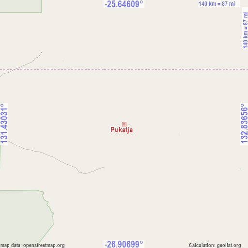
Pukatja GPS coordinates[2]
26° 16' 41.7" South, 132° 8' 0.348" East
| Map corner | latitude | longitude |
|---|---|---|
| Upper-left | -25.64609°, | 131.43031° |
| Center: | -26.27825°, | 132.13343° |
| Lower-right: | -26.90699°, | 132.83656° |
| Map W x H: | 140.2×140.2 km | = 87.1×87.1mi |
| max Lat: | -10.58257° ⇑11.8% North |
| Pukatja: | -26.27825° |
| min Lat: | ⇓88.2% South -43.31423° |
| min Long | Pukatja | max Long |
| 113.53327° | 132.13343° | 153.61246° |
| W 12.9%⇐ | ⇒87.1% E |
Elevation
Elevation of Pukatja is 679 m = 2228 ft, and this is 557 m = 1827 ft above average elevation for this country.
| Max E: |
1715 m = 5627 ft | 1.9% |
| Pukatja | 679 m 2228 ft | |
| Avg. | 122 m = 400 ft | |
Min E: |
-2 m = -7 ft | 98.1% |
See also: Australia elevation on elevation.city.
Geographical zone
Pukatja is located in South temperate zone (between Tropic of Capricorn and the Antarctic Circle). Distance of this Southern Tropic circle is 315.9 km =196.3 mi to North.| Distance of | km | miles | from Pukatja |
|---|---|---|---|
| Equator | 2921.9 | 1815.6 | to North |
| Tropic Capricorn | 315.9 | 196.3 | to North |
| Antarctic Circle | 4479.3 | 2783.3 | to South |
| South Pole | 7085.2 | 4402.5 | to South |


Nearby cities:
15 places around Pukatja: (largest is in red/bold)
• Alice Springs
336.8 km =209.3 mi,  31°
31°
• Alice Springs city centre
336.8 km =209.3 mi, 31°
• Araluen
335.4 km =208.4 mi, 31°
• Desert Springs
335.3 km =208.3 mi, 31°
• Gillen
334.8 km =208 mi, 31°
• Hermannsburg
266.8 km =165.8 mi,  14°
14°
• Hugh
263.2 km =163.5 mi, 33°
• Ilparpa
328.1 km =203.9 mi, 31°
• Larapinta
334.5 km =207.8 mi, 30°
• Mount Johns
335.9 km =208.7 mi, 32°
• Petermann
229.6 km =142.7 mi,  344°
344°
• Ross
333.5 km =207.2 mi, 32°
• Santa Teresa
328.3 km =204 mi,  43°
43°
• The Gap
334.8 km =208 mi, 31°
• Yulara
162.6 km =101 mi,  315°
315°
Sources, notices
• [Note1] Compared only with cities in Australia existing in our database
• [Src1] Map data: © OpenStreetMap contributors (CC-BY-SA)
• [Src2] Other city data from geonames.org with taken over terms of usage.
• [Src3] Geographical zone / Annual Mean Temperature by Robert A. Rohde @ Wikipedia
