Aghsu geodata
Aghsu (Ağsu) is a seat of a first-order administrative division; located in Azerbaijan in Asia/Baku (GMT+4) time zone. With population of 17,209 people, there are 49 cities with bigger population in this country. Compared to other cities in Azerbaijan, 64.3% of cities are located further ↓South; 58.9% of cities are located further ←West and 50.3% of cities have lower elevation than Aghsu. Note1


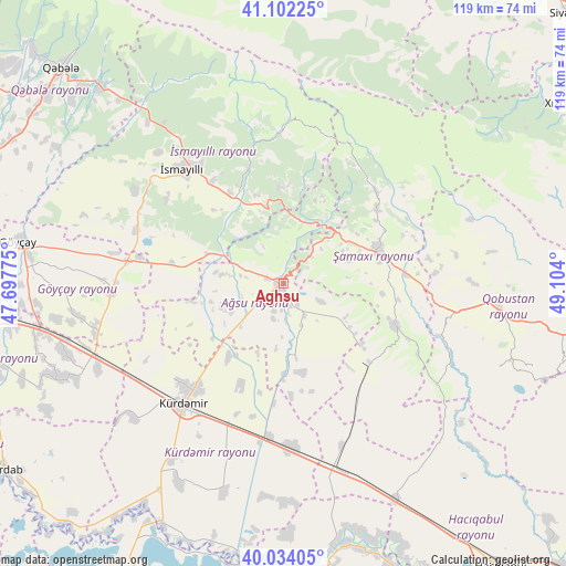
Aghsu GPS coordinates[2]
40° 34' 13.008" North, 48° 24' 3.132" East
| Map corner | latitude | longitude |
|---|---|---|
| Upper-left | 41.10225°, | 47.69775° |
| Center: | 40.57028°, | 48.40087° |
| Lower-right: | 40.03405°, | 49.104° |
| Map W x H: | 118.8×118.8 km | = 73.8×73.8mi |
| max Lat: | 41.75259° ⇑35.7% North |
| Aghsu: | 40.57028° |
| min Lat: | ⇓64.3% South 38.45598° |
| min Long | Aghsu | max Long |
| 44.84846° | 48.40087° | 50.84003° |
| W 58.9%⇐ | ⇒41.1% E |
Elevation
Elevation of Aghsu is 179 m = 587 ft, and this is 204 m = 669 ft below average elevation for this country.
| Max E: |
2211 m = 7254 ft | 49.7% |
| Avg. | 383 m = 1257 ft | |
| Aghsu | 179 m = 587 ft | |
Min E: |
-26 m = -85 ft | 50.3% |
See also: Azerbaijan elevation on elevation.city.
Geographical zone
Aghsu is located in North temperate zone (between Tropic of Cancer and the Arctic Circle). Distance of this Northern Tropic circle is 1905.1 km =1183.8 mi to South.| Distance of | km | miles | from Aghsu |
|---|---|---|---|
| North Pole | 5496.1 | 3415.1 | to North |
| Arctic Circle | 2890.2 | 1795.9 | to North |
| Tropic Cancer | 1905.1 | 1183.8 | to South |
| Equator | 4511 | 2803 | to South |


Nearby cities:
15 places around Aghsu: (largest is in red/bold)
• Altıağac
55.2 km =34.3 mi,  54°
54°
• Basqal
20.6 km =12.8 mi,  357°
357°
• Begimli
60.4 km =37.5 mi,  234°
234°
• Geoktschai
56.3 km =35 mi,  279°
279°
• Khyzy
68.1 km =42.3 mi,  56°
56°
• Kyurdarmir
32.7 km =20.3 mi,  219°
219°
• Lahıc
30.7 km =19.1 mi, 357°
• Mughan
63.3 km =39.3 mi,  145°
145°
• Qobustan
44.7 km =27.8 mi,  95°
95°
• Qutqashen
65.3 km =40.6 mi,  314°
314°
• Sabirabad
62.8 km =39 mi,  174°
174°
• Shamakhi
21.4 km =13.3 mi,  71°
71°
• Ujar
63.3 km =39.3 mi,  264°
264°
• Zardob
70.2 km =43.6 mi,  236°
236°
• İsmayıllı
31.8 km =19.8 mi,  318°
318°
Sources, notices
• [Note1] Compared only with cities in Azerbaijan existing in our database
• [Src1] Map data: © OpenStreetMap contributors (CC-BY-SA)
• [Src2] Other city data from geonames.org with taken over terms of usage.
• [Src3] Geographical zone / Annual Mean Temperature by Robert A. Rohde @ Wikipedia
