Sirajganj geodata
Sirajganj (Rajshahi Division) is a populated place; located in Bangladesh in Asia/Dhaka (GMT+6) time zone. With population of 127,481 people, there are 31 cities with bigger population in this country. Compared to other cities in Bangladesh, 72.6% of cities are located further ↓South; 64.1% of cities are located further →East and 66.7% of cities have lower elevation than Sirajganj. Note1
Administrative division(s):
- Level 1: Rajshahi Division
- Level 2: Sirajganj
- Level 3: Sirajganj Sadar
- Level 4: Paurashava


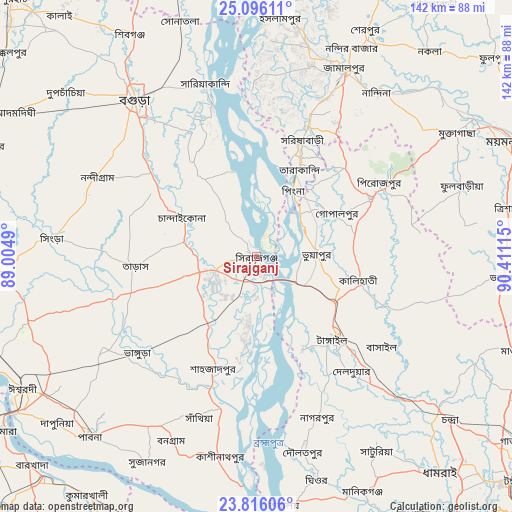
Sirajganj GPS coordinates[2]
24° 27' 27.756" North, 89° 42' 28.872" East
| Map corner | latitude | longitude |
|---|---|---|
| Upper-left | 25.09611°, | 89.0049° |
| Center: | 24.45771°, | 89.70802° |
| Lower-right: | 23.81606°, | 90.41115° |
| Map W x H: | 142.3×142.3 km | = 88.4×88.4mi |
| max Lat: | 26.33338° ⇑27.4% North |
| Sirajganj: | 24.45771° |
| min Lat: | ⇓72.6% South 20.85829° |
| min Long | Sirajganj | max Long |
| 88.15638° | 89.70802° | 92.29773° |
| W 35.9%⇐ | ⇒64.1% E |
Elevation
Elevation of Sirajganj is 19 m = 62 ft, and this is 1.1 m = 4 ft above average elevation for this country.
| Max E: |
79 m = 259 ft | 33.3% |
| Sirajganj | 19 m 62 ft | |
| Avg. | 17.9 m = 59 ft | |
Min E: |
2 m = 7 ft | 66.7% |
See also: Sirajganj elevation on elevation.city.
Geographical zone
Sirajganj is located in North temperate zone (between Tropic of Cancer and the Arctic Circle). Distance of this Northern Tropic circle is 113.5 km =70.5 mi to South.| Distance of | km | miles | from Sirajganj |
|---|---|---|---|
| North Pole | 7287.6 | 4528.3 | to North |
| Arctic Circle | 4681.7 | 2909.1 | to North |
| Tropic Cancer | 113.5 | 70.5 | to South |
| Equator | 2719.4 | 1689.8 | to South |


Nearby cities:
15 places around Sirajganj: (largest is in red/bold)
• Bera
42.9 km =26.7 mi,  190°
190°
• Bogra
55.4 km =34.4 mi,  322°
322°
• Jamālpur
56.8 km =35.3 mi,  25°
25°
• Mahasthangarh
67 km =41.6 mi,  326°
326°
• Mirzāpur
55.9 km =34.7 mi,  134°
134°
• Muktāgācha
65.2 km =40.5 mi,  58°
58°
• Natore
73.2 km =45.5 mi,  265°
265°
• Nāgarpur
47.6 km =29.6 mi,  158°
158°
• Pābna
69.3 km =43.1 mi,  223°
223°
• Sakhipur
49.2 km =30.6 mi,  108°
108°
• Sarishābāri
34.9 km =21.7 mi,  20°
20°
• Sherpur
69.8 km =43.4 mi, 26°
• Shibganj
71.9 km =44.7 mi, 327°
• Shāhzādpur
33.1 km =20.6 mi,  199°
199°
• Tāngāil
31.3 km =19.4 mi,  137°
137°
Sources, notices
• [Note1] Compared only with cities in Bangladesh existing in our database
• [Src1] Map data: © OpenStreetMap contributors (CC-BY-SA)
• [Src2] Other city data from geonames.org with taken over terms of usage.
• [Src3] Geographical zone / Annual Mean Temperature by Robert A. Rohde @ Wikipedia
