Herselt geodata
Herselt (Flanders) is a populated place; located in Belgium in Europe/Brussels (GMT+2) time zone. With population of 13,493 people, there are 220 cities with bigger population in this country. Compared to other cities in Belgium, 75.8% of cities are located further ↓South; 61.7% of cities are located further ←West and 74.9% of cities have higher elevation than Herselt. Note1
Administrative division(s):
- Level 1: Flanders
- Level 2: Provincie Antwerpen
- Level 3: Arrondissement Turnhout
- Level 4: Herselt


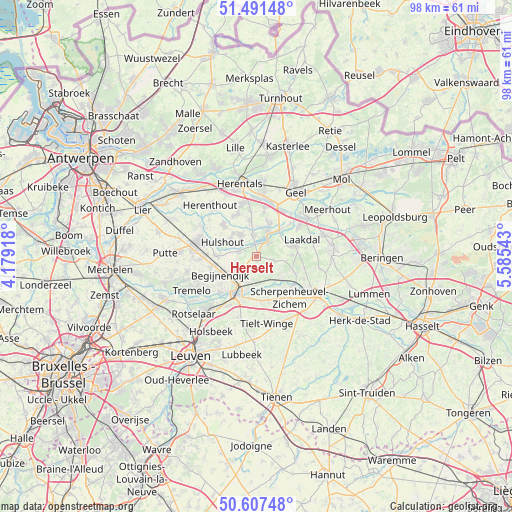
Herselt GPS coordinates[2]
51° 3' 5.724" North, 4° 52' 56.316" East
| Map corner | latitude | longitude |
|---|---|---|
| Upper-left | 51.49148°, | 4.17918° |
| Center: | 51.05159°, | 4.88231° |
| Lower-right: | 50.60748°, | 5.58543° |
| Map W x H: | 98.3×98.3 km | = 61.1×61.1mi |
| max Lat: | 51.46791° ⇑24.2% North |
| Herselt: | 51.05159° |
| min Lat: | ⇓75.8% South 49.53771° |
| min Long | Herselt | max Long |
| 2.59368° | 4.88231° | 6.25749° |
| W 61.7%⇐ | ⇒38.3% E |
Elevation
Elevation of Herselt is 18 m = 59 ft, and this is 81.5 m = 267 ft below average elevation for this country.
| Max E: |
582 m = 1909 ft | 74.9% |
| Avg. | 99.5 m = 326 ft | |
| Herselt | 18 m = 59 ft | |
Min E: |
1 m = 3 ft | 25.1% |
See also: Belgium elevation on elevation.city.
Geographical zone
Herselt is located in North temperate zone (between Tropic of Cancer and the Arctic Circle). Distance of this North polar circle is 1724.8 km =1071.7 mi to North.| Distance of | km | miles | from Herselt |
|---|---|---|---|
| North Pole | 4330.7 | 2691 | to North |
| Arctic Circle | 1724.8 | 1071.7 | to North |
| Tropic Cancer | 3070.5 | 1907.9 | to South |
| Equator | 5676.4 | 3527.2 | to South |


Nearby cities:
15 places around Herselt: (largest is in red/bold)
• Aarschot
7.8 km =4.8 mi,  203°
203°
• Begijnendijk
7.8 km =4.8 mi,  242°
242°
• Bekkevoort
13.7 km =8.5 mi,  153°
153°
• Diest
13.7 km =8.5 mi,  120°
120°
• Geel
14.7 km =9.1 mi,  30°
30°
• Heist-op-den-Berg
11.1 km =6.9 mi,  283°
283°
• Herentals
14.3 km =8.9 mi,  345°
345°
• Herenthout
13.2 km =8.2 mi,  318°
318°
• Hulshout
6.9 km =4.3 mi,  291°
291°
• Laakdal
9.2 km =5.7 mi,  69°
69°
• Olen
10.4 km =6.5 mi, 351°
• Scherpenheuvel-Zichem
7.9 km =4.9 mi,  125°
125°
• Tessenderlo
14.5 km =9 mi,  84°
84°
• Tremelo
13.9 km =8.6 mi, 241°
• Westerlo
4.9 km =3 mi, 28°
Sources, notices
• [Note1] Compared only with cities in Belgium existing in our database
• [Src1] Map data: © OpenStreetMap contributors (CC-BY-SA)
• [Src2] Other city data from geonames.org with taken over terms of usage.
• [Src3] Geographical zone / Annual Mean Temperature by Robert A. Rohde @ Wikipedia
