Haacht geodata
Haacht (Flanders) is a populated place; located in Belgium in Europe/Brussels (GMT+2) time zone. With population of 13,541 people, there are 215 cities with bigger population in this country. Compared to other cities in Belgium, 67.9% of cities are located further ↓South; 52.9% of cities are located further ←West and 86.5% of cities have higher elevation than Haacht. Note1
Administrative division(s):
- Level 1: Flanders
- Level 2: Provincie Vlaams-Brabant
- Level 3: Arrondissement Leuven
- Level 4: Haacht


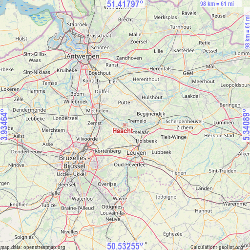
Haacht GPS coordinates[2]
50° 58' 38.532" North, 4° 38' 15.972" East
| Map corner | latitude | longitude |
|---|---|---|
| Upper-left | 51.41797°, | 3.93464° |
| Center: | 50.97737°, | 4.63777° |
| Lower-right: | 50.53255°, | 5.34089° |
| Map W x H: | 98.4×98.4 km | = 61.1×61.1mi |
| max Lat: | 51.46791° ⇑32.1% North |
| Haacht: | 50.97737° |
| min Lat: | ⇓67.9% South 49.53771° |
| min Long | Haacht | max Long |
| 2.59368° | 4.63777° | 6.25749° |
| W 52.9%⇐ | ⇒47.1% E |
Elevation
Elevation of Haacht is 10 m = 33 ft, and this is 89.5 m = 294 ft below average elevation for this country.
| Max E: |
582 m = 1909 ft | 86.5% |
| Avg. | 99.5 m = 326 ft | |
| Haacht | 10 m = 33 ft | |
Min E: |
1 m = 3 ft | 13.5% |
See also: Belgium elevation on elevation.city.
Geographical zone
Haacht is located in North temperate zone (between Tropic of Cancer and the Arctic Circle). Distance of this North polar circle is 1733 km =1076.8 mi to North.| Distance of | km | miles | from Haacht |
|---|---|---|---|
| North Pole | 4338.9 | 2696.1 | to North |
| Arctic Circle | 1733 | 1076.8 | to North |
| Tropic Cancer | 3062.2 | 1902.8 | to South |
| Equator | 5668.2 | 3522.1 | to South |


Nearby cities:
15 places around Haacht: (largest is in red/bold)
• Begijnendijk
11.2 km =7 mi,  65°
65°
• Bonheiden
8.1 km =5 mi,  308°
308°
• Boortmeerbeek
4.4 km =2.7 mi,  272°
272°
• Herent
8 km =5 mi,  163°
163°
• Holsbeek
10.5 km =6.5 mi,  126°
126°
• Kampenhout
7.2 km =4.5 mi,  237°
237°
• Keerbergen
2.9 km =1.8 mi,  355°
355°
• Kortenberg
11.8 km =7.3 mi,  214°
214°
• Leuven
11.7 km =7.3 mi, 157°
• Putte
8.5 km =5.3 mi, 357°
• Rotselaar
6.2 km =3.9 mi,  116°
116°
• Sint-Katelijne-Waver
12.3 km =7.6 mi,  324°
324°
• Steenokkerzeel
11.1 km =6.9 mi,  233°
233°
• Tremelo
5.2 km =3.2 mi, 71°
• Zemst
12.4 km =7.7 mi, 272°
Sources, notices
• [Note1] Compared only with cities in Belgium existing in our database
• [Src1] Map data: © OpenStreetMap contributors (CC-BY-SA)
• [Src2] Other city data from geonames.org with taken over terms of usage.
• [Src3] Geographical zone / Annual Mean Temperature by Robert A. Rohde @ Wikipedia
