Holsbeek geodata
Holsbeek (Flanders) is a populated place; located in Belgium in Europe/Brussels (GMT+2) time zone. With population of 9,094 people, there are 333 cities with bigger population in this country. Compared to other cities in Belgium, 63.4% of cities are located further ↓South; 57% of cities are located further ←West and 71.3% of cities have higher elevation than Holsbeek. Note1
Administrative division(s):
- Level 1: Flanders
- Level 2: Provincie Vlaams-Brabant
- Level 3: Arrondissement Leuven
- Level 4: Holsbeek


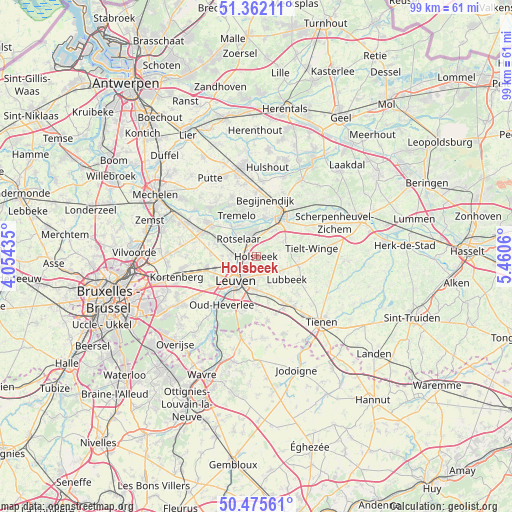
Holsbeek GPS coordinates[2]
50° 55' 15.492" North, 4° 45' 26.892" East
| Map corner | latitude | longitude |
|---|---|---|
| Upper-left | 51.36211°, | 4.05435° |
| Center: | 50.92097°, | 4.75747° |
| Lower-right: | 50.47561°, | 5.4606° |
| Map W x H: | 98.6×98.6 km | = 61.3×61.3mi |
| max Lat: | 51.46791° ⇑36.6% North |
| Holsbeek: | 50.92097° |
| min Lat: | ⇓63.4% South 49.53771° |
| min Long | Holsbeek | max Long |
| 2.59368° | 4.75747° | 6.25749° |
| W 57%⇐ | ⇒43% E |
Elevation
Elevation of Holsbeek is 21 m = 69 ft, and this is 78.5 m = 258 ft below average elevation for this country.
| Max E: |
582 m = 1909 ft | 71.3% |
| Avg. | 99.5 m = 326 ft | |
| Holsbeek | 21 m = 69 ft | |
Min E: |
1 m = 3 ft | 28.7% |
See also: Belgium elevation on elevation.city.
Geographical zone
Holsbeek is located in North temperate zone (between Tropic of Cancer and the Arctic Circle). Distance of this North polar circle is 1739.3 km =1080.8 mi to North.| Distance of | km | miles | from Holsbeek |
|---|---|---|---|
| North Pole | 4345.2 | 2700 | to North |
| Arctic Circle | 1739.3 | 1080.8 | to North |
| Tropic Cancer | 3056 | 1898.9 | to South |
| Equator | 5661.9 | 3518.1 | to South |


Nearby cities:
15 places around Holsbeek: (largest is in red/bold)
• Aarschot
9.2 km =5.7 mi,  37°
37°
• Begijnendijk
11.1 km =6.9 mi,  9°
9°
• Bertem
11 km =6.8 mi,  234°
234°
• Bierbeek
10.3 km =6.4 mi,  179°
179°
• Boortmeerbeek
14.4 km =8.9 mi,  296°
296°
• Boutersem
11 km =6.8 mi,  150°
150°
• Haacht
10.5 km =6.5 mi,  306°
306°
• Herent
6.2 km =3.9 mi,  257°
257°
• Kampenhout
14.7 km =9.1 mi,  279°
279°
• Keerbergen
12.5 km =7.8 mi,  316°
316°
• Leuven
6.1 km =3.8 mi,  220°
220°
• Lubbeek
7.1 km =4.4 mi,  126°
126°
• Oud-Heverlee
11.6 km =7.2 mi,  214°
214°
• Rotselaar
4.6 km =2.9 mi, 321°
• Tremelo
8.7 km =5.4 mi,  336°
336°
Sources, notices
• [Note1] Compared only with cities in Belgium existing in our database
• [Src1] Map data: © OpenStreetMap contributors (CC-BY-SA)
• [Src2] Other city data from geonames.org with taken over terms of usage.
• [Src3] Geographical zone / Annual Mean Temperature by Robert A. Rohde @ Wikipedia
