Rotselaar geodata
Rotselaar (Flanders) is a populated place; located in Belgium in Europe/Brussels (GMT+2) time zone. With population of 15,007 people, there are 183 cities with bigger population in this country. Compared to other cities in Belgium, 66.2% of cities are located further ↓South; 55.8% of cities are located further ←West and 82.3% of cities have higher elevation than Rotselaar. Note1
Administrative division(s):
- Level 1: Flanders
- Level 2: Provincie Vlaams-Brabant
- Level 3: Arrondissement Leuven
- Level 4: Rotselaar


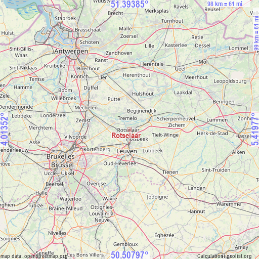
Rotselaar GPS coordinates[2]
50° 57' 10.872" North, 4° 42' 59.94" East
| Map corner | latitude | longitude |
|---|---|---|
| Upper-left | 51.39385°, | 4.01352° |
| Center: | 50.95302°, | 4.71665° |
| Lower-right: | 50.50797°, | 5.41977° |
| Map W x H: | 98.5×98.5 km | = 61.2×61.2mi |
| max Lat: | 51.46791° ⇑33.8% North |
| Rotselaar: | 50.95302° |
| min Lat: | ⇓66.2% South 49.53771° |
| min Long | Rotselaar | max Long |
| 2.59368° | 4.71665° | 6.25749° |
| W 55.8%⇐ | ⇒44.2% E |
Elevation
Elevation of Rotselaar is 12 m = 39 ft, and this is 87.5 m = 287 ft below average elevation for this country.
| Max E: |
582 m = 1909 ft | 82.3% |
| Avg. | 99.5 m = 326 ft | |
| Rotselaar | 12 m = 39 ft | |
Min E: |
1 m = 3 ft | 17.7% |
See also: Belgium elevation on elevation.city.
Geographical zone
Rotselaar is located in North temperate zone (between Tropic of Cancer and the Arctic Circle). Distance of this North polar circle is 1735.7 km =1078.5 mi to North.| Distance of | km | miles | from Rotselaar |
|---|---|---|---|
| North Pole | 4341.6 | 2697.7 | to North |
| Arctic Circle | 1735.7 | 1078.5 | to North |
| Tropic Cancer | 3059.5 | 1901.1 | to South |
| Equator | 5665.4 | 3520.3 | to South |


Nearby cities:
15 places around Rotselaar: (largest is in red/bold)
• Aarschot
9.2 km =5.7 mi,  65°
65°
• Begijnendijk
8.8 km =5.5 mi,  32°
32°
• Bertem
11.6 km =7.2 mi,  211°
211°
• Boortmeerbeek
10.4 km =6.5 mi,  286°
286°
• Haacht
6.2 km =3.9 mi,  296°
296°
• Heist-op-den-Berg
13.6 km =8.5 mi,  3°
3°
• Herent
5.9 km =3.7 mi, 213°
• Holsbeek
4.6 km =2.9 mi,  141°
141°
• Kampenhout
11.7 km =7.3 mi,  264°
264°
• Keerbergen
8 km =5 mi,  313°
313°
• Leuven
8.2 km =5.1 mi,  187°
187°
• Lubbeek
11.6 km =7.2 mi,  132°
132°
• Oud-Heverlee
13.6 km =8.5 mi,  195°
195°
• Putte
12.6 km =7.8 mi,  332°
332°
• Tremelo
4.4 km =2.7 mi,  352°
352°
Sources, notices
• [Note1] Compared only with cities in Belgium existing in our database
• [Src1] Map data: © OpenStreetMap contributors (CC-BY-SA)
• [Src2] Other city data from geonames.org with taken over terms of usage.
• [Src3] Geographical zone / Annual Mean Temperature by Robert A. Rohde @ Wikipedia
