Riberalta geodata
Riberalta (El Beni) is a populated place; located in Bolivia in America/La_Paz (GMT-4) time zone. With population of 74,014 people, there are 12 cities with bigger population in this country. Compared to other cities in Bolivia, 98.8% of cities are located further ↓South; 68.3% of cities are located further →East and 96.3% of cities have higher elevation than Riberalta. Note1
Administrative division(s):
- Level 1: El Beni
- Level 2: Provincia Vaca Diez
- Level 3: Riberalta Municipality


Riberalta GPS coordinates[2]
11° 0' 23.544" South, 66° 3' 47.232" West
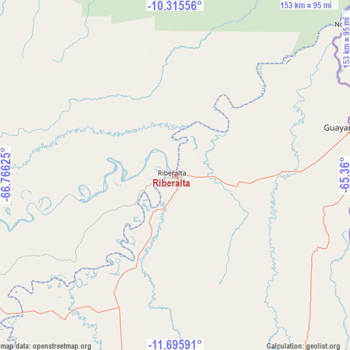
| Map corner | latitude | longitude |
|---|---|---|
| Upper-left | -10.31556°, | -66.76625° |
| Center: | -11.00654°, | -66.06312° |
| Lower-right: | -11.69591°, | -65.36° |
| Map W x H: | 153.5×153.5 km | = 95.4×95.4mi |
| max Lat: | -9.71828° ⇑1.2% North |
| Riberalta: | -11.00654° |
| min Lat: | ⇓98.8% South -22.73206° |
| min Long | Riberalta | max Long |
| -69.14843° | -66.06312° | -57.76667° |
| W 31.7%⇐ | ⇒68.3% E |
Elevation
Elevation of Riberalta is 150 m = 492 ft, and this is 1861.3 m = 6107 ft below average elevation for this country.
| Max E: |
4732 m = 15525 ft | 96.3% |
| Avg. | 2011.3 m = 6599 ft | |
| Riberalta | 150 m = 492 ft | |
Min E: |
92 m = 302 ft | 3.7% |
See also: Riberalta elevation on elevation.city.
Geographical zone
Riberalta is located in South Torrid zone (between Equator and Tropic of Capricorn). Distance of Equator is 1223.8 km =760.4 mi to North.| Distance of | km | miles | from Riberalta |
|---|---|---|---|
| Equator | 1223.8 | 760.4 | to North |
| Tropic Capricorn | 1382.1 | 858.8 | to South |
| Antarctic Circle | 6177.4 | 3838.5 | to South |
| South Pole | 8783.2 | 5457.6 | to South |


Nearby cities:
11 places around Riberalta: (largest is in red/bold)
• Cobija
295.3 km =183.5 mi,  269°
269°
• Guayaramerín
79.6 km =49.5 mi,  75°
75°
• Nueva Manoa
160.8 km =99.9 mi,  27°
27°
• Reyes
390.9 km =242.9 mi,  200°
200°
• Rurrenabaque
413.6 km =257 mi, 202°
• San Borja
432.1 km =268.5 mi,  191°
191°
• San Borja
434 km =269.7 mi, 189°
• San Ramón
292.4 km =181.7 mi,  149°
149°
• Santa Ana de Yacuma
312.1 km =193.9 mi,  167°
167°
• Santa Rosa
362.5 km =225.2 mi, 194°
• Trinidad
443.8 km =275.8 mi,  163°
163°
Sources, notices
• [Note1] Compared only with cities in Bolivia existing in our database
• [Src1] Map data: © OpenStreetMap contributors (CC-BY-SA)
• [Src2] Other city data from geonames.org with taken over terms of usage.
• [Src3] Geographical zone / Annual Mean Temperature by Robert A. Rohde @ Wikipedia
