San Ramón geodata
San Ramón (El Beni) is a populated place; located in Bolivia in America/La_Paz (GMT-4) time zone. With population of 4,389 people, there are 65 cities with bigger population in this country. Compared to other cities in Bolivia, 97.5% of cities are located further ↓South; 62.7% of cities are located further ←West and 98.1% of cities have higher elevation than San Ramón. Note1


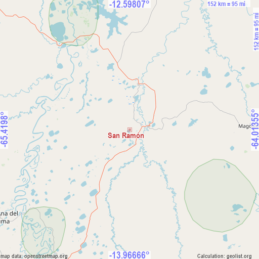
San Ramón GPS coordinates[2]
13° 16' 59.988" South, 64° 43' 0.012" West
| Map corner | latitude | longitude |
|---|---|---|
| Upper-left | -12.59807°, | -65.4198° |
| Center: | -13.28333°, | -64.71667° |
| Lower-right: | -13.96666°, | -64.01355° |
| Map W x H: | 152.2×152.2 km | = 94.6×94.6mi |
| max Lat: | -9.71828° ⇑2.5% North |
| San Ramón: | -13.28333° |
| min Lat: | ⇓97.5% South -22.73206° |
| min Long | San Ramón | max Long |
| -69.14843° | -64.71667° | -57.76667° |
| W 62.7%⇐ | ⇒37.3% E |
Elevation
Elevation of San Ramón is 136 m = 446 ft, and this is 1875.3 m = 6153 ft below average elevation for this country.
| Max E: |
4732 m = 15525 ft | 98.1% |
| Avg. | 2011.3 m = 6599 ft | |
| San Ramón | 136 m = 446 ft | |
Min E: |
92 m = 302 ft | 1.9% |
See also: Bolivia elevation on elevation.city.
Geographical zone
San Ramón is located in South Torrid zone (between Equator and Tropic of Capricorn). Distance of this Southern Tropic circle is 1129 km =701.5 mi to South.| Distance of | km | miles | from San Ramón |
|---|---|---|---|
| Equator | 1477 | 917.8 | to North |
| Tropic Capricorn | 1129 | 701.5 | to South |
| Antarctic Circle | 5924.2 | 3681.1 | to South |
| South Pole | 8530.1 | 5300.4 | to South |


Nearby cities:
15 places around San Ramón: (largest is in red/bold)
• Ascención de Guarayos
333.5 km =207.2 mi,  150°
150°
• Ascensión
321.1 km =199.5 mi, 146°
• Chimoré
415.3 km =258.1 mi,  186°
186°
• Guanay
420.6 km =261.3 mi,  234°
234°
• Guayaramerín
282 km =175.2 mi,  345°
345°
• Nueva Manoa
403.2 km =250.5 mi, 349°
• Reyes
304.4 km =189.1 mi,  248°
248°
• Riberalta
292.4 km =181.7 mi,  329°
329°
• Rurrenabaque
329.6 km =204.8 mi, 247°
• San Borja
280.2 km =174.1 mi, 231°
• San Borja
286.4 km =178 mi, 233°
• Santa Ana de Yacuma
92.3 km =57.4 mi,  236°
236°
• Santa Rosa
253.8 km =157.7 mi, 247°
• Trinidad
173.5 km =107.8 mi, 186°
• Urubichá
302.3 km =187.8 mi,  140°
140°
Sources, notices
• [Note1] Compared only with cities in Bolivia existing in our database
• [Src1] Map data: © OpenStreetMap contributors (CC-BY-SA)
• [Src2] Other city data from geonames.org with taken over terms of usage.
• [Src3] Geographical zone / Annual Mean Temperature by Robert A. Rohde @ Wikipedia
