Santa Rosa geodata
Santa Rosa (El Beni) is a populated place; located in Bolivia in America/La_Paz (GMT-4) time zone. With population of 4,459 people, there are 63 cities with bigger population in this country. Compared to other cities in Bolivia, 96.3% of cities are located further ↓South; 78.9% of cities are located further →East and 95% of cities have higher elevation than Santa Rosa. Note1


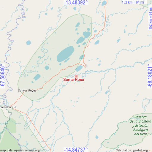
Santa Rosa GPS coordinates[2]
14° 10' 0.012" South, 66° 52' 59.988" West
| Map corner | latitude | longitude |
|---|---|---|
| Upper-left | -13.48392°, | -67.58646° |
| Center: | -14.16667°, | -66.88333° |
| Lower-right: | -14.84737°, | -66.18021° |
| Map W x H: | 151.6×151.6 km | = 94.2×94.2mi |
| max Lat: | -9.71828° ⇑3.7% North |
| Santa Rosa: | -14.16667° |
| min Lat: | ⇓96.3% South -22.73206° |
| min Long | Santa Rosa | max Long |
| -69.14843° | -66.88333° | -57.76667° |
| W 21.1%⇐ | ⇒78.9% E |
Elevation
Elevation of Santa Rosa is 167 m = 548 ft, and this is 1844.3 m = 6051 ft below average elevation for this country.
| Max E: |
4732 m = 15525 ft | 95% |
| Avg. | 2011.3 m = 6599 ft | |
| Santa Rosa | 167 m = 548 ft | |
Min E: |
92 m = 302 ft | 5% |
See also: Bolivia elevation on elevation.city.
Geographical zone
Santa Rosa is located in South Torrid zone (between Equator and Tropic of Capricorn). Distance of this Southern Tropic circle is 1030.7 km =640.4 mi to South.| Distance of | km | miles | from Santa Rosa |
|---|---|---|---|
| Equator | 1575.2 | 978.8 | to North |
| Tropic Capricorn | 1030.7 | 640.4 | to South |
| Antarctic Circle | 5826 | 3620.1 | to South |
| South Pole | 8431.9 | 5239.3 | to South |


Nearby cities:
15 places around Santa Rosa: (largest is in red/bold)
• Achacachi
284.9 km =177 mi,  222°
222°
• Amarete
255.4 km =158.7 mi,  242°
242°
• Chulumani
258.7 km =160.7 mi,  195°
195°
• Coripata
249.4 km =155 mi, 197°
• Coroico
243 km =151 mi, 201°
• Guanay
182.9 km =113.6 mi, 215°
• Mapiri
183.2 km =113.8 mi,  228°
228°
• Reyes
50.9 km =31.6 mi,  253°
253°
• Rurrenabaque
75.9 km =47.2 mi, 246°
• San Borja
72.4 km =45 mi,  177°
177°
• San Borja
77.5 km =48.2 mi,  169°
169°
• San Ramón
253.8 km =157.7 mi,  67°
67°
• Santa Ana de Yacuma
164 km =101.9 mi, 73°
• Sorata
260.6 km =161.9 mi, 226°
• Trinidad
226 km =140.4 mi,  109°
109°
Sources, notices
• [Note1] Compared only with cities in Bolivia existing in our database
• [Src1] Map data: © OpenStreetMap contributors (CC-BY-SA)
• [Src2] Other city data from geonames.org with taken over terms of usage.
• [Src3] Geographical zone / Annual Mean Temperature by Robert A. Rohde @ Wikipedia
