San Borja geodata
San Borja (El Beni) is a populated place; located in Bolivia in America/La_Paz (GMT-4) time zone. With population of 24,610 people, there are 21 cities with bigger population in this country. Compared to other cities in Bolivia, 93.2% of cities are located further ↓South; 74.5% of cities are located further →East and 93.2% of cities have higher elevation than San Borja. Note1


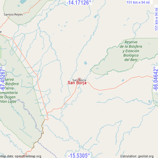
San Borja GPS coordinates[2]
14° 51' 7.02" South, 66° 44' 58.344" West
| Map corner | latitude | longitude |
|---|---|---|
| Upper-left | -14.17126°, | -67.45267° |
| Center: | -14.85195°, | -66.74954° |
| Lower-right: | -15.5305°, | -66.04642° |
| Map W x H: | 151.1×151.1 km | = 93.9×93.9mi |
| max Lat: | -9.71828° ⇑6.8% North |
| San Borja: | -14.85195° |
| min Lat: | ⇓93.2% South -22.73206° |
| min Long | San Borja | max Long |
| -69.14843° | -66.74954° | -57.76667° |
| W 25.5%⇐ | ⇒74.5% E |
Elevation
Elevation of San Borja is 195 m = 640 ft, and this is 1816.3 m = 5959 ft below average elevation for this country.
| Max E: |
4732 m = 15525 ft | 93.2% |
| Avg. | 2011.3 m = 6599 ft | |
| San Borja | 195 m = 640 ft | |
Min E: |
92 m = 302 ft | 6.8% |
See also: Bolivia elevation on elevation.city.
Geographical zone
San Borja is located in South Torrid zone (between Equator and Tropic of Capricorn). Distance of this Southern Tropic circle is 954.5 km =593.1 mi to South.| Distance of | km | miles | from San Borja |
|---|---|---|---|
| Equator | 1651.4 | 1026.1 | to North |
| Tropic Capricorn | 954.5 | 593.1 | to South |
| Antarctic Circle | 5749.8 | 3572.8 | to South |
| South Pole | 8355.7 | 5192 | to South |


Nearby cities:
15 places around San Borja: (largest is in red/bold)
• Amarete
243.8 km =151.5 mi,  259°
259°
• Chulumani
192.2 km =119.4 mi,  205°
205°
• Coripata
185 km =115 mi, 209°
• Coroico
182.5 km =113.4 mi,  215°
215°
• Guanay
141.3 km =87.8 mi,  239°
239°
• La Paz
236.8 km =147.1 mi, 219°
• Mapiri
158.5 km =98.5 mi,  253°
253°
• Quime
242.2 km =150.5 mi,  191°
191°
• Reyes
88.4 km =54.9 mi,  314°
314°
• Rurrenabaque
95.4 km =59.3 mi,  298°
298°
• San Borja
11.5 km =7.1 mi,  289°
289°
• Santa Ana de Yacuma
188.4 km =117.1 mi,  49°
49°
• Santa Rosa
77.5 km =48.2 mi,  349°
349°
• Sorata
228.1 km =141.7 mi, 243°
• Trinidad
198.8 km =123.5 mi,  89°
89°
Sources, notices
• [Note1] Compared only with cities in Bolivia existing in our database
• [Src1] Map data: © OpenStreetMap contributors (CC-BY-SA)
• [Src2] Other city data from geonames.org with taken over terms of usage.
• [Src3] Geographical zone / Annual Mean Temperature by Robert A. Rohde @ Wikipedia
