Colchani geodata
Colchani (Potosí) is a populated place; located in Bolivia in America/La_Paz (GMT-4) time zone. With population of 11,988 people, there are 37 cities with bigger population in this country. Compared to other cities in Bolivia, 83.2% of cities are located further ↑North; 79.5% of cities are located further →East and 80.1% of cities have lower elevation than Colchani. Note1


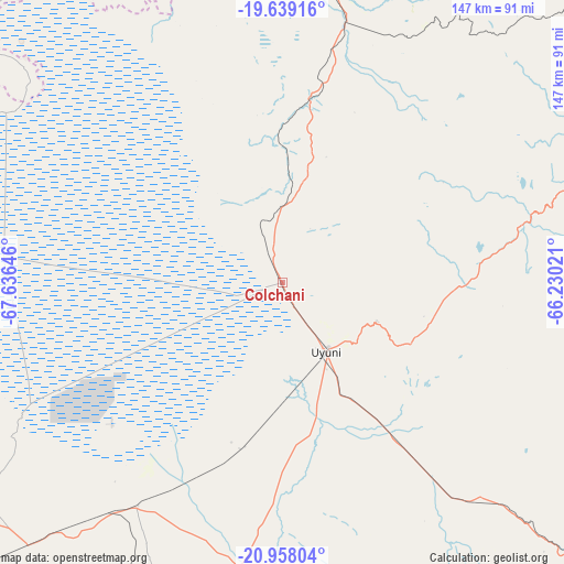
Colchani GPS coordinates[2]
20° 18' 0" South, 66° 55' 59.988" West
| Map corner | latitude | longitude |
|---|---|---|
| Upper-left | -19.63916°, | -67.63646° |
| Center: | -20.3°, | -66.93333° |
| Lower-right: | -20.95804°, | -66.23021° |
| Map W x H: | 146.6×146.6 km | = 91.1×91.1mi |
| max Lat: | -9.71828° ⇑83.2% North |
| Colchani: | -20.3° |
| min Lat: | ⇓16.8% South -22.73206° |
| min Long | Colchani | max Long |
| -69.14843° | -66.93333° | -57.76667° |
| W 20.5%⇐ | ⇒79.5% E |
Elevation
Elevation of Colchani is 3668 m = 12034 ft, and this is 1656.7 m = 5435 ft above average elevation for this country.
| Max E: |
4732 m = 15525 ft | 19.9% |
| Colchani | 3668 m 12034 ft | |
| Avg. | 2011.3 m = 6599 ft | |
Min E: |
92 m = 302 ft | 80.1% |
See also: Bolivia elevation on elevation.city.
Geographical zone
Colchani is located in South Torrid zone (between Equator and Tropic of Capricorn). Distance of this Southern Tropic circle is 348.8 km =216.7 mi to South.| Distance of | km | miles | from Colchani |
|---|---|---|---|
| Equator | 2257.1 | 1402.5 | to North |
| Tropic Capricorn | 348.8 | 216.7 | to South |
| Antarctic Circle | 5144 | 3196.3 | to South |
| South Pole | 7749.9 | 4815.6 | to South |


Nearby cities:
15 places around Colchani: (largest is in red/bold)
• Andamarca
179.5 km =111.5 mi,  340°
340°
• Atocha
102.4 km =63.6 mi,  133°
133°
• Betanzos
175.5 km =109.1 mi,  61°
61°
• Camargo
183.6 km =114.1 mi,  101°
101°
• Challapata
156.4 km =97.2 mi,  6°
6°
• Colquechaca
202.8 km =126 mi,  28°
28°
• Las Carreras
201.4 km =125.1 mi,  121°
121°
• Las Carreras
205.7 km =127.8 mi, 119°
• Lintaca
174.5 km =108.4 mi,  107°
107°
• Potosí
146.8 km =91.2 mi, 57°
• San Juan
200.9 km =124.8 mi, 122°
• Santa Bárbara
114.7 km =71.3 mi, 126°
• Totoral
200.7 km =124.7 mi,  1°
1°
• Tupiza
179.1 km =111.3 mi,  135°
135°
• Uyuni
21 km =13 mi,  147°
147°
Sources, notices
• [Note1] Compared only with cities in Bolivia existing in our database
• [Src1] Map data: © OpenStreetMap contributors (CC-BY-SA)
• [Src2] Other city data from geonames.org with taken over terms of usage.
• [Src3] Geographical zone / Annual Mean Temperature by Robert A. Rohde @ Wikipedia
