São João dos Inhamuns geodata
São João dos Inhamuns (Ceará) is a populated place; located in Brazil in America/Fortaleza (GMT-3) time zone. With population of 29,188 people, there are 684 cities with bigger population in this country. Compared to other cities in Brazil, 85.2% of cities are located further ↓South; 74.1% of cities are located further ←West and 53.7% of cities have lower elevation than São João dos Inhamuns. Note1


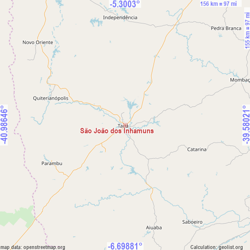
São João dos Inhamuns GPS coordinates[2]
6° 0' 0" South, 40° 16' 59.988" West
| Map corner | latitude | longitude |
|---|---|---|
| Upper-left | -5.3003°, | -40.98646° |
| Center: | -6°, | -40.28333° |
| Lower-right: | -6.69881°, | -39.58021° |
| Map W x H: | 155.5×155.5 km | = 96.6×96.6mi |
| max Lat: | 2.81972° ⇑14.8% North |
| São João dos Inhamuns: | -6° |
| min Lat: | ⇓85.2% South -33.69111° |
| min Long | São João dos | max Long |
| -72.89583° | -40.28333° | -32.41083° |
| W 74.1%⇐ | ⇒25.9% E |
Elevation
Elevation of São João dos Inhamuns is 405 m = 1329 ft, and this is 24.1 m = 79 ft above average elevation for this country.
| Max E: |
1603 m = 5259 ft | 46.3% |
| São João dos Inhamuns | 405 m 1329 ft | |
| Avg. | 380.9 m = 1250 ft | |
Min E: |
0 m = 0 ft | 53.7% |
See also: Brazil elevation on elevation.city.
Geographical zone
São João dos Inhamuns is located in South Torrid zone (between Equator and Tropic of Capricorn). Distance of Equator is 667.1 km =414.5 mi to North.| Distance of | km | miles | from São João dos Inhamuns |
|---|---|---|---|
| Equator | 667.1 | 414.5 | to North |
| Tropic Capricorn | 1938.8 | 1204.7 | to South |
| Antarctic Circle | 6734 | 4184.3 | to South |
| South Pole | 9339.9 | 5803.5 | to South |


Nearby cities:
15 places around São João dos Inhamuns: (largest is in red/bold)
• Acopiara
92.5 km =57.5 mi,  96°
96°
• Assaré
107.2 km =66.6 mi,  155°
155°
• Boa Viagem
114.6 km =71.2 mi,  32°
32°
• Crateús
101.2 km =62.9 mi,  334°
334°
• Iguatu
116 km =72.1 mi,  110°
110°
• Independência
67.2 km =41.8 mi,  357°
357°
• Ipueiras
116.4 km =72.3 mi,  189°
189°
• Jucás
101.9 km =63.3 mi,  124°
124°
• Mombaça
78 km =48.5 mi,  68°
68°
• Novo Oriente
75 km =46.6 mi,  313°
313°
• Parambu
51.2 km =31.8 mi,  242°
242°
• Pedra Branca
87.2 km =54.2 mi,  45°
45°
• Pio IX
98.7 km =61.3 mi,  199°
199°
• Senador Pompeu
110.8 km =68.8 mi, 65°
• Várzea Alegre
73.1 km =45.4 mi,  351°
351°
Sources, notices
• [Note1] Compared only with cities in Brazil existing in our database
• [Src1] Map data: © OpenStreetMap contributors (CC-BY-SA)
• [Src2] Other city data from geonames.org with taken over terms of usage.
• [Src3] Geographical zone / Annual Mean Temperature by Robert A. Rohde @ Wikipedia
