Mombaça geodata
Mombaça (Ceará) is a populated place; located in Brazil in America/Fortaleza (GMT-3) time zone. With population of 17,065 people, there are 1092 cities with bigger population in this country. Compared to other cities in Brazil, 86.2% of cities are located further ↓South; 76.7% of cities are located further ←West and 56.3% of cities have higher elevation than Mombaça. Note1


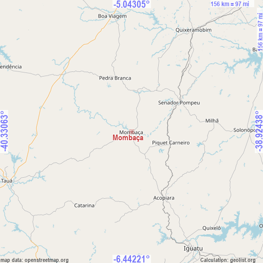
Mombaça GPS coordinates[2]
5° 44' 35.016" South, 39° 37' 39" West
| Map corner | latitude | longitude |
|---|---|---|
| Upper-left | -5.04305°, | -40.33063° |
| Center: | -5.74306°, | -39.6275° |
| Lower-right: | -6.44221°, | -38.92438° |
| Map W x H: | 155.6×155.6 km | = 96.7×96.7mi |
| max Lat: | 2.81972° ⇑13.8% North |
| Mombaça: | -5.74306° |
| min Lat: | ⇓86.2% South -33.69111° |
| min Long | Mombaça | max Long |
| -72.89583° | -39.6275° | -32.41083° |
| W 76.7%⇐ | ⇒23.3% E |
Elevation
Elevation of Mombaça is 251 m = 823 ft, and this is 129.9 m = 426 ft below average elevation for this country.
| Max E: |
1603 m = 5259 ft | 56.3% |
| Avg. | 380.9 m = 1250 ft | |
| Mombaça | 251 m = 823 ft | |
Min E: |
0 m = 0 ft | 43.7% |
See also: Brazil elevation on elevation.city.
Geographical zone
Mombaça is located in South Torrid zone (between Equator and Tropic of Capricorn). Distance of Equator is 638.6 km =396.8 mi to North.| Distance of | km | miles | from Mombaça |
|---|---|---|---|
| Equator | 638.6 | 396.8 | to North |
| Tropic Capricorn | 1967.4 | 1222.5 | to South |
| Antarctic Circle | 6762.6 | 4202.1 | to South |
| South Pole | 9368.5 | 5821.3 | to South |


Nearby cities:
15 places around Mombaça: (largest is in red/bold)
• Acopiara
43.7 km =27.2 mi,  153°
153°
• Boa Viagem
69.4 km =43.1 mi,  350°
350°
• Cedro
114.6 km =71.2 mi, 146°
• Icó
111.9 km =69.5 mi,  130°
130°
• Iguatu
77.6 km =48.2 mi, 152°
• Independência
84.7 km =52.6 mi,  297°
297°
• Jaguaribe
112.4 km =69.8 mi,  98°
98°
• Jucás
87.7 km =54.5 mi,  172°
172°
• Orós
96.6 km =60 mi, 125°
• Pedra Branca
33.6 km =20.9 mi,  342°
342°
• Quixadá
109.3 km =67.9 mi,  38°
38°
• Quixeramobim
70.9 km =44.1 mi,  31°
31°
• Senador Pompeu
33.1 km =20.6 mi,  58°
58°
• São João dos Inhamuns
78 km =48.5 mi,  248°
248°
• Várzea Alegre
94.4 km =58.7 mi, 297°
Sources, notices
• [Note1] Compared only with cities in Brazil existing in our database
• [Src1] Map data: © OpenStreetMap contributors (CC-BY-SA)
• [Src2] Other city data from geonames.org with taken over terms of usage.
• [Src3] Geographical zone / Annual Mean Temperature by Robert A. Rohde @ Wikipedia
