Bom Jardim geodata
Bom Jardim (Maranhão) is a populated place; located in Brazil in America/Fortaleza (GMT-3) time zone. With population of 12,343 people, there are 1446 cities with bigger population in this country. Compared to other cities in Brazil, 80.7% of cities are located further ↓South; 54.8% of cities are located further →East and 55.5% of cities have lower elevation than Bom Jardim. Note1


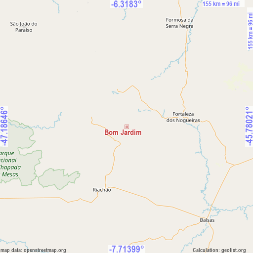
Bom Jardim GPS coordinates[2]
7° 1' 0.012" South, 46° 28' 59.988" West
| Map corner | latitude | longitude |
|---|---|---|
| Upper-left | -6.3183°, | -47.18646° |
| Center: | -7.01667°, | -46.48333° |
| Lower-right: | -7.71399°, | -45.78021° |
| Map W x H: | 155.2×155.2 km | = 96.4×96.4mi |
| max Lat: | 2.81972° ⇑19.3% North |
| Bom Jardim: | -7.01667° |
| min Lat: | ⇓80.7% South -33.69111° |
| min Long | Bom Jardim | max Long |
| -72.89583° | -46.48333° | -32.41083° |
| W 45.2%⇐ | ⇒54.8% E |
Elevation
Elevation of Bom Jardim is 426 m = 1398 ft, and this is 45.1 m = 148 ft above average elevation for this country.
| Max E: |
1603 m = 5259 ft | 44.5% |
| Bom Jardim | 426 m 1398 ft | |
| Avg. | 380.9 m = 1250 ft | |
Min E: |
0 m = 0 ft | 55.5% |
See also: Brazil elevation on elevation.city.
Geographical zone
Bom Jardim is located in South Torrid zone (between Equator and Tropic of Capricorn). Distance of Equator is 780.2 km =484.8 mi to North.| Distance of | km | miles | from Bom Jardim |
|---|---|---|---|
| Equator | 780.2 | 484.8 | to North |
| Tropic Capricorn | 1825.7 | 1134.4 | to South |
| Antarctic Circle | 6621 | 4114.1 | to South |
| South Pole | 9226.9 | 5733.3 | to South |


Nearby cities:
15 places around Bom Jardim: (largest is in red/bold)
• Amarante do Maranhão
163.7 km =101.7 mi,  349°
349°
• Araguaína
191.2 km =118.8 mi,  264°
264°
• Balsas
75.7 km =47 mi,  139°
139°
• Barra do Corda
216.8 km =134.7 mi,  39°
39°
• Carolina
113.7 km =70.6 mi,  251°
251°
• Grajaú
138.5 km =86.1 mi,  15°
15°
• Imperatriz
199.7 km =124.1 mi,  326°
326°
• Mirador
244.9 km =152.2 mi,  72°
72°
• Montes Altos
146.5 km =91 mi, 333°
• Porto Franco
126.2 km =78.4 mi,  306°
306°
• Riachão
41.1 km =25.5 mi,  201°
201°
• Santa Luzia
106.8 km =66.4 mi,  229°
229°
• São Geraldo do Araguaia
238.8 km =148.4 mi,  286°
286°
• São Raimundo das Mangabeiras
110.6 km =68.7 mi,  90°
90°
• Uruçuí
213.9 km =132.9 mi,  96°
96°
Sources, notices
• [Note1] Compared only with cities in Brazil existing in our database
• [Src1] Map data: © OpenStreetMap contributors (CC-BY-SA)
• [Src2] Other city data from geonames.org with taken over terms of usage.
• [Src3] Geographical zone / Annual Mean Temperature by Robert A. Rohde @ Wikipedia
