Telêmaco Borba geodata
Telêmaco Borba (Paraná) is a populated place; located in Brazil in America/Sao_Paulo (GMT-3) time zone. With population of 58,880 people, there are 375 cities with bigger population in this country. Compared to other cities in Brazil, 86.9% of cities are located further ↑North; 81.1% of cities are located further →East and 83.2% of cities have lower elevation than Telêmaco Borba. Note1


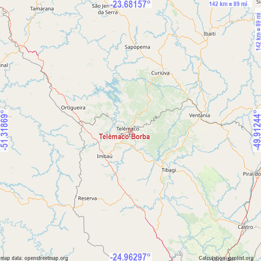
Telêmaco Borba GPS coordinates[2]
24° 19' 26.004" South, 50° 36' 56.016" West
| Map corner | latitude | longitude |
|---|---|---|
| Upper-left | -23.68157°, | -51.31869° |
| Center: | -24.32389°, | -50.61556° |
| Lower-right: | -24.96297°, | -49.91244° |
| Map W x H: | 142.5×142.5 km | = 88.5×88.5mi |
| max Lat: | 2.81972° ⇑86.9% North |
| Telêmaco Borba: | -24.32389° |
| min Lat: | ⇓13.1% South -33.69111° |
| min Long | Telêmaco Borba | max Long |
| -72.89583° | -50.61556° | -32.41083° |
| W 18.9%⇐ | ⇒81.1% E |
Elevation
Elevation of Telêmaco Borba is 736 m = 2415 ft, and this is 355.1 m = 1165 ft above average elevation for this country.
| Max E: |
1603 m = 5259 ft | 16.8% |
| Telêmaco Borba | 736 m 2415 ft | |
| Avg. | 380.9 m = 1250 ft | |
Min E: |
0 m = 0 ft | 83.2% |
See also: Telêmaco Borba elevation on elevation.city.
Geographical zone
Telêmaco Borba is located in South temperate zone (between Tropic of Capricorn and the Antarctic Circle). Distance of this Southern Tropic circle is 98.6 km =61.3 mi to North.| Distance of | km | miles | from Telêmaco Borba |
|---|---|---|---|
| Equator | 2704.6 | 1680.6 | to North |
| Tropic Capricorn | 98.6 | 61.3 | to North |
| Antarctic Circle | 4696.6 | 2918.3 | to South |
| South Pole | 7302.5 | 4537.6 | to South |


Nearby cities:
15 places around Telêmaco Borba: (largest is in red/bold)
• Carambeí
86.2 km =53.6 mi,  144°
144°
• Castro
80 km =49.7 mi,  130°
130°
• Cândido de Abreu
77.5 km =48.2 mi,  249°
249°
• Faxinal
80 km =49.7 mi,  296°
296°
• Ibaiti
68.4 km =42.5 mi,  39°
39°
• Imbituva
100.8 km =62.6 mi,  179°
179°
• Jaguariaíva
92.3 km =57.4 mi,  84°
84°
• Ortigueira
36.2 km =22.5 mi,  290°
290°
• Piraí do Sul
71.2 km =44.2 mi,  108°
108°
• Ponta Grossa
97.2 km =60.4 mi,  151°
151°
• Prudentópolis
105.4 km =65.5 mi,  200°
200°
• Reserva
43.4 km =27 mi,  213°
213°
• Terra Roxa
78.9 km =49 mi,  48°
48°
• Tibagi
29 km =18 mi, 135°
• Wenceslau Braz
96.5 km =60 mi,  58°
58°
Sources, notices
• [Note1] Compared only with cities in Brazil existing in our database
• [Src1] Map data: © OpenStreetMap contributors (CC-BY-SA)
• [Src2] Other city data from geonames.org with taken over terms of usage.
• [Src3] Geographical zone / Annual Mean Temperature by Robert A. Rohde @ Wikipedia
