Ibiá geodata
Ibiá (Minas Gerais) is a populated place; located in Brazil in America/Sao_Paulo (GMT-3) time zone. With population of 18,428 people, there are 1013 cities with bigger population in this country. Compared to other cities in Brazil, 54.5% of cities are located further ↑North; 55.1% of cities are located further →East and 94.9% of cities have lower elevation than Ibiá. Note1


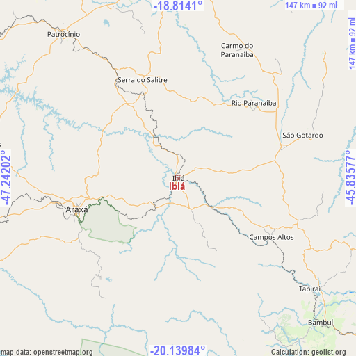
Ibiá GPS coordinates[2]
19° 28' 41.988" South, 46° 32' 20.004" West
| Map corner | latitude | longitude |
|---|---|---|
| Upper-left | -18.8141°, | -47.24202° |
| Center: | -19.47833°, | -46.53889° |
| Lower-right: | -20.13984°, | -45.83577° |
| Map W x H: | 147.4×147.4 km | = 91.6×91.6mi |
| max Lat: | 2.81972° ⇑54.5% North |
| Ibiá: | -19.47833° |
| min Lat: | ⇓45.5% South -33.69111° |
| min Long | Ibiá | max Long |
| -72.89583° | -46.53889° | -32.41083° |
| W 44.9%⇐ | ⇒55.1% E |
Elevation
Elevation of Ibiá is 894 m = 2933 ft, and this is 513.1 m = 1683 ft above average elevation for this country.
| Max E: |
1603 m = 5259 ft | 5.1% |
| Ibiá | 894 m 2933 ft | |
| Avg. | 380.9 m = 1250 ft | |
Min E: |
0 m = 0 ft | 94.9% |
See also: Brazil elevation on elevation.city.
Geographical zone
Ibiá is located in South Torrid zone (between Equator and Tropic of Capricorn). Distance of this Southern Tropic circle is 440.1 km =273.5 mi to South.| Distance of | km | miles | from Ibiá |
|---|---|---|---|
| Equator | 2165.8 | 1345.8 | to North |
| Tropic Capricorn | 440.1 | 273.5 | to South |
| Antarctic Circle | 5235.4 | 3253.1 | to South |
| South Pole | 7841.3 | 4872.4 | to South |


Nearby cities:
15 places around Ibiá: (largest is in red/bold)
• Abaeté
120 km =74.6 mi,  72°
72°
• Araxá
44 km =27.3 mi,  253°
253°
• Bambuí
83.1 km =51.6 mi,  134°
134°
• Campos Altos
45.5 km =28.3 mi,  122°
122°
• Carmo do Paranaíba
58 km =36 mi,  23°
23°
• Dores do Indaiá
98.3 km =61.1 mi,  89°
89°
• Lagoa Formosa
79 km =49.1 mi,  10°
10°
• Lagoa da Prata
120.5 km =74.9 mi, 120°
• Luz
96.3 km =59.8 mi,  111°
111°
• Patos de Minas
100 km =62.1 mi,  1°
1°
• Patrocínio
76.2 km =47.3 mi,  321°
321°
• Piuí
125.4 km =77.9 mi,  151°
151°
• Presidente Olegário
118.6 km =73.7 mi, 6°
• Sacramento
103.7 km =64.4 mi, 245°
• São Gotardo
54.7 km =34 mi, 70°
Sources, notices
• [Note1] Compared only with cities in Brazil existing in our database
• [Src1] Map data: © OpenStreetMap contributors (CC-BY-SA)
• [Src2] Other city data from geonames.org with taken over terms of usage.
• [Src3] Geographical zone / Annual Mean Temperature by Robert A. Rohde @ Wikipedia
