Rio Bananal geodata
Rio Bananal (Espírito Santo) is a populated place; located in Brazil in America/Sao_Paulo (GMT-3) time zone. With population of 4,814 people, there are 1927 cities with bigger population in this country. Compared to other cities in Brazil, 53.9% of cities are located further ↑North; 73.7% of cities are located further ←West and 76.1% of cities have higher elevation than Rio Bananal. Note1


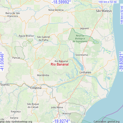
Rio Bananal GPS coordinates[2]
19° 15' 54" South, 40° 19' 59.988" West
| Map corner | latitude | longitude |
|---|---|---|
| Upper-left | -18.59992°, | -41.03646° |
| Center: | -19.265°, | -40.33333° |
| Lower-right: | -19.9274°, | -39.63021° |
| Map W x H: | 147.6×147.6 km | = 91.7×91.7mi |
| max Lat: | 2.81972° ⇑53.9% North |
| Rio Bananal: | -19.265° |
| min Lat: | ⇓46.1% South -33.69111° |
| min Long | Rio Bananal | max Long |
| -72.89583° | -40.33333° | -32.41083° |
| W 73.7%⇐ | ⇒26.3% E |
Elevation
Elevation of Rio Bananal is 70 m = 230 ft, and this is 310.9 m = 1020 ft below average elevation for this country.
| Max E: |
1603 m = 5259 ft | 76.1% |
| Avg. | 380.9 m = 1250 ft | |
| Rio Bananal | 70 m = 230 ft | |
Min E: |
0 m = 0 ft | 23.9% |
See also: Brazil elevation on elevation.city.
Geographical zone
Rio Bananal is located in South Torrid zone (between Equator and Tropic of Capricorn). Distance of this Southern Tropic circle is 463.9 km =288.3 mi to South.| Distance of | km | miles | from Rio Bananal |
|---|---|---|---|
| Equator | 2142.1 | 1331 | to North |
| Tropic Capricorn | 463.9 | 288.3 | to South |
| Antarctic Circle | 5259.1 | 3267.9 | to South |
| South Pole | 7865 | 4887.1 | to South |


Nearby cities:
15 places around Rio Bananal: (largest is in red/bold)
• Aimorés
80.8 km =50.2 mi,  251°
251°
• Aracruz
62.1 km =38.6 mi,  174°
174°
• Baixo Guandu
76.9 km =47.8 mi, 248°
• Boa Esperança
80.7 km =50.1 mi,  2°
2°
• Colatina
43.6 km =27.1 mi,  225°
225°
• Fundão
74.8 km =46.5 mi,  185°
185°
• Ibiraçu
63.2 km =39.3 mi,  183°
183°
• João Neiva
55 km =34.2 mi, 185°
• Linhares
30.8 km =19.1 mi,  117°
117°
• Marilândia
27.3 km =17 mi, 233°
• Nova Venécia
62.1 km =38.6 mi,  353°
353°
• Pancas
54.6 km =33.9 mi,  274°
274°
• Santa Teresa
79.6 km =49.5 mi,  200°
200°
• São Mateus
78.5 km =48.8 mi,  39°
39°
• Águia Branca
53 km =32.9 mi,  306°
306°
Sources, notices
• [Note1] Compared only with cities in Brazil existing in our database
• [Src1] Map data: © OpenStreetMap contributors (CC-BY-SA)
• [Src2] Other city data from geonames.org with taken over terms of usage.
• [Src3] Geographical zone / Annual Mean Temperature by Robert A. Rohde @ Wikipedia
