Livramento do Brumado geodata
Livramento do Brumado (Bahia) is a populated place; located in Brazil in America/Bahia (GMT-3) time zone. With population of 19,914 people, there are 943 cities with bigger population in this country. Compared to other cities in Brazil, 58.7% of cities are located further ↓South; 66.6% of cities are located further ←West and 59.2% of cities have lower elevation than Livramento do Brumado. Note1
Current local time in Livramento do Brumado:
05:16 PM, ThursdayDifference from your time zone: hours


Livramento do Brumado GPS coordinates[2]
13° 39' 5.22" South, 41° 50' 44.304" West
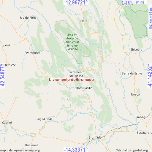
| Map corner | latitude | longitude |
|---|---|---|
| Upper-left | -12.96721°, | -42.54877° |
| Center: | -13.65145°, | -41.84564° |
| Lower-right: | -14.33371°, | -41.14252° |
| Map W x H: | 151.9×151.9 km | = 94.4×94.4mi |
| max Lat: | 2.81972° ⇑41.3% North |
| Livramento do Brumado: | -13.65145° |
| min Lat: | ⇓58.7% South -33.69111° |
| min Long | Livramento do B | max Long |
| -72.89583° | -41.84564° | -32.41083° |
| W 66.6%⇐ | ⇒33.4% E |
Elevation
Elevation of Livramento do Brumado is 465 m = 1526 ft, and this is 84.1 m = 276 ft above average elevation for this country.
| Max E: |
1603 m = 5259 ft | 40.8% |
| Livramento do Brumado | 465 m 1526 ft | |
| Avg. | 380.9 m = 1250 ft | |
Min E: |
0 m = 0 ft | 59.2% |
See also: Brazil elevation on elevation.city.
Geographical zone
Livramento do Brumado is located in South Torrid zone (between Equator and Tropic of Capricorn). Distance of this Southern Tropic circle is 1088 km =676.1 mi to South.| Distance of | km | miles | from Livramento do Brumado |
|---|---|---|---|
| Equator | 1517.9 | 943.2 | to North |
| Tropic Capricorn | 1088 | 676.1 | to South |
| Antarctic Circle | 5883.3 | 3655.7 | to South |
| South Pole | 8489.2 | 5274.9 | to South |


Nearby cities:
15 places around Livramento do Brumado: (largest is in red/bold)
• Anagé
131.4 km =81.6 mi,  144°
144°
• Barra da Estiva
56.1 km =34.9 mi,  87°
87°
• Boquira
132.9 km =82.6 mi,  313°
313°
• Brumado
64.4 km =40 mi,  162°
162°
• Caculé
103.1 km =64.1 mi,  203°
203°
• Caetité
82.3 km =51.1 mi,  235°
235°
• Guanambi
119.3 km =74.1 mi, 237°
• Ituaçu
62 km =38.5 mi,  106°
106°
• Macaúbas
116 km =72.1 mi, 307°
• Paramirim
48.4 km =30.1 mi,  298°
298°
• Riacho de Santana
118.2 km =73.4 mi,  272°
272°
• Santana
90.8 km =56.4 mi,  176°
176°
• Seabra
137.5 km =85.4 mi,  3°
3°
• São Felipe
140.8 km =87.5 mi, 159°
• Tanhaçu
76.5 km =47.5 mi,  122°
122°
Sources, notices
• [Note1] Compared only with cities in Brazil existing in our database
• [Src1] Map data: © OpenStreetMap contributors (CC-BY-SA)
• [Src2] Other city data from geonames.org with taken over terms of usage.
• [Src3] Geographical zone / Annual Mean Temperature by Robert A. Rohde @ Wikipedia
