Iaciara geodata
Iaciara (Goiás) is a populated place; located in Brazil in America/Sao_Paulo (GMT-3) time zone. With population of 9,207 people, there are 1706 cities with bigger population in this country. Compared to other cities in Brazil, 58.1% of cities are located further ↓South; 55.8% of cities are located further →East and 70.4% of cities have lower elevation than Iaciara. Note1


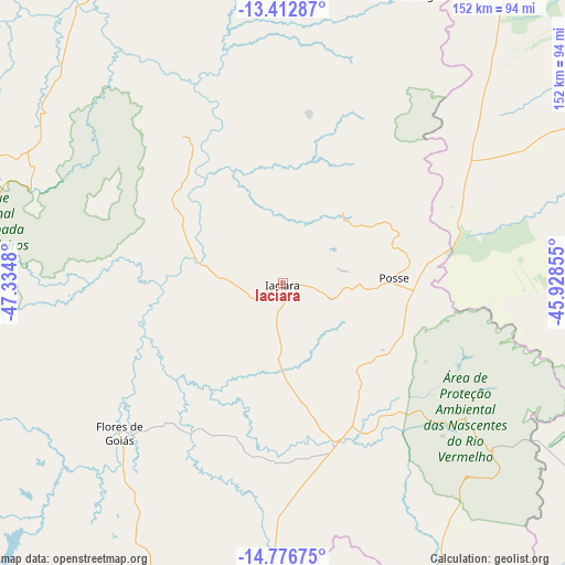
Iaciara GPS coordinates[2]
14° 5' 44.988" South, 46° 37' 54.012" West
| Map corner | latitude | longitude |
|---|---|---|
| Upper-left | -13.41287°, | -47.3348° |
| Center: | -14.09583°, | -46.63167° |
| Lower-right: | -14.77675°, | -45.92855° |
| Map W x H: | 151.6×151.7 km | = 94.2×94.3mi |
| max Lat: | 2.81972° ⇑41.9% North |
| Iaciara: | -14.09583° |
| min Lat: | ⇓58.1% South -33.69111° |
| min Long | Iaciara | max Long |
| -72.89583° | -46.63167° | -32.41083° |
| W 44.2%⇐ | ⇒55.8% E |
Elevation
Elevation of Iaciara is 579 m = 1900 ft, and this is 198.1 m = 650 ft above average elevation for this country.
| Max E: |
1603 m = 5259 ft | 29.6% |
| Iaciara | 579 m 1900 ft | |
| Avg. | 380.9 m = 1250 ft | |
Min E: |
0 m = 0 ft | 70.4% |
See also: Brazil elevation on elevation.city.
Geographical zone
Iaciara is located in South Torrid zone (between Equator and Tropic of Capricorn). Distance of this Southern Tropic circle is 1038.6 km =645.4 mi to South.| Distance of | km | miles | from Iaciara |
|---|---|---|---|
| Equator | 1567.3 | 973.9 | to North |
| Tropic Capricorn | 1038.6 | 645.4 | to South |
| Antarctic Circle | 5833.9 | 3625 | to South |
| South Pole | 8439.8 | 5244.2 | to South |


Nearby cities:
15 places around Iaciara: (largest is in red/bold)
• Arinos
210.2 km =130.6 mi,  164°
164°
• Arraias
133.7 km =83.1 mi,  345°
345°
• Buritis
170.7 km =106.1 mi,  172°
172°
• Campos Belos
118.7 km =73.8 mi, 352°
• Cavalcante
95.2 km =59.2 mi,  290°
290°
• Correntina
231.2 km =143.7 mi,  68°
68°
• Formosa
177.2 km =110.1 mi,  205°
205°
• Minaçu
182.6 km =113.5 mi, 290°
• Niquelândia
201.4 km =125.1 mi,  257°
257°
• Padre Bernardo
213.8 km =132.8 mi,  236°
236°
• Planaltina
184.2 km =114.5 mi, 214°
• Planaltina
201.5 km =125.2 mi, 212°
• Posse
28.3 km =17.6 mi,  89°
89°
• São Domingos
84.6 km =52.6 mi,  23°
23°
• Taguatinga
189.3 km =117.6 mi,  6°
6°
Sources, notices
• [Note1] Compared only with cities in Brazil existing in our database
• [Src1] Map data: © OpenStreetMap contributors (CC-BY-SA)
• [Src2] Other city data from geonames.org with taken over terms of usage.
• [Src3] Geographical zone / Annual Mean Temperature by Robert A. Rohde @ Wikipedia
