Padre Bernardo geodata
Padre Bernardo (Goiás) is a populated place; located in Brazil in America/Sao_Paulo (GMT-3) time zone. With population of 16,118 people, there are 1149 cities with bigger population in this country. Compared to other cities in Brazil, 55.7% of cities are located further ↓South; 66% of cities are located further →East and 76.2% of cities have lower elevation than Padre Bernardo. Note1


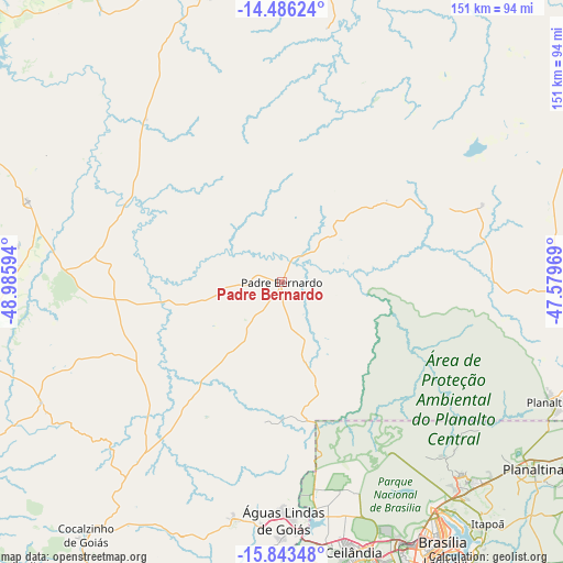
Padre Bernardo GPS coordinates[2]
15° 9' 57.42" South, 48° 16' 58.116" West
| Map corner | latitude | longitude |
|---|---|---|
| Upper-left | -14.48624°, | -48.98594° |
| Center: | -15.16595°, | -48.28281° |
| Lower-right: | -15.84348°, | -47.57969° |
| Map W x H: | 150.9×150.9 km | = 93.8×93.8mi |
| max Lat: | 2.81972° ⇑44.3% North |
| Padre Bernardo: | -15.16595° |
| min Lat: | ⇓55.7% South -33.69111° |
| min Long | Padre Bernardo | max Long |
| -72.89583° | -48.28281° | -32.41083° |
| W 34%⇐ | ⇒66% E |
Elevation
Elevation of Padre Bernardo is 642 m = 2106 ft, and this is 261.1 m = 857 ft above average elevation for this country.
| Max E: |
1603 m = 5259 ft | 23.8% |
| Padre Bernardo | 642 m 2106 ft | |
| Avg. | 380.9 m = 1250 ft | |
Min E: |
0 m = 0 ft | 76.2% |
See also: Brazil elevation on elevation.city.
Geographical zone
Padre Bernardo is located in South Torrid zone (between Equator and Tropic of Capricorn). Distance of this Southern Tropic circle is 919.6 km =571.4 mi to South.| Distance of | km | miles | from Padre Bernardo |
|---|---|---|---|
| Equator | 1686.3 | 1047.8 | to North |
| Tropic Capricorn | 919.6 | 571.4 | to South |
| Antarctic Circle | 5714.9 | 3551.1 | to South |
| South Pole | 8320.8 | 5170.3 | to South |


Nearby cities:
15 places around Padre Bernardo: (largest is in red/bold)
• Abadiânia
124 km =77.1 mi,  201°
201°
• Barro Alto
71.3 km =44.3 mi,  287°
287°
• Brasília
78 km =48.5 mi,  150°
150°
• Ceres
142 km =88.2 mi,  263°
263°
• Formosa
109.7 km =68.2 mi,  112°
112°
• Goianésia
91.1 km =56.6 mi, 259°
• Itapaci
138.1 km =85.8 mi,  279°
279°
• Jaraguá
130.5 km =81.1 mi,  239°
239°
• Luziânia
125.9 km =78.2 mi,  163°
163°
• Niquelândia
79.3 km =49.3 mi,  346°
346°
• Pirenópolis
105.2 km =65.4 mi,  223°
223°
• Planaltina
78.5 km =48.8 mi, 113°
• Planaltina
84.5 km =52.5 mi,  126°
126°
• Rialma
140.6 km =87.4 mi, 263°
• Uruaçu
116.6 km =72.5 mi,  307°
307°
Sources, notices
• [Note1] Compared only with cities in Brazil existing in our database
• [Src1] Map data: © OpenStreetMap contributors (CC-BY-SA)
• [Src2] Other city data from geonames.org with taken over terms of usage.
• [Src3] Geographical zone / Annual Mean Temperature by Robert A. Rohde @ Wikipedia
