Diamantino geodata
Diamantino (Mato Grosso) is a populated place; located in Brazil in America/Cuiaba (GMT-4) time zone. With population of 15,699 people, there are 1175 cities with bigger population in this country. Compared to other cities in Brazil, 57.5% of cities are located further ↓South; 95.8% of cities are located further →East and 54.3% of cities have higher elevation than Diamantino. Note1


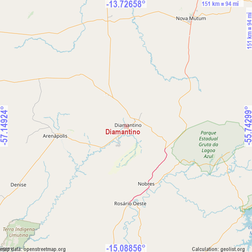
Diamantino GPS coordinates[2]
14° 24' 30.996" South, 56° 26' 45.996" West
| Map corner | latitude | longitude |
|---|---|---|
| Upper-left | -13.72658°, | -57.14924° |
| Center: | -14.40861°, | -56.44611° |
| Lower-right: | -15.08856°, | -55.74299° |
| Map W x H: | 151.4×151.4 km | = 94.1×94.1mi |
| max Lat: | 2.81972° ⇑42.5% North |
| Diamantino: | -14.40861° |
| min Lat: | ⇓57.5% South -33.69111° |
| min Long | Diamantino | max Long |
| -72.89583° | -56.44611° | -32.41083° |
| W 4.2%⇐ | ⇒95.8% E |
Elevation
Elevation of Diamantino is 282 m = 925 ft, and this is 98.9 m = 324 ft below average elevation for this country.
| Max E: |
1603 m = 5259 ft | 54.3% |
| Avg. | 380.9 m = 1250 ft | |
| Diamantino | 282 m = 925 ft | |
Min E: |
0 m = 0 ft | 45.7% |
See also: Brazil elevation on elevation.city.
Geographical zone
Diamantino is located in South Torrid zone (between Equator and Tropic of Capricorn). Distance of this Southern Tropic circle is 1003.8 km =623.7 mi to South.| Distance of | km | miles | from Diamantino |
|---|---|---|---|
| Equator | 1602.1 | 995.5 | to North |
| Tropic Capricorn | 1003.8 | 623.7 | to South |
| Antarctic Circle | 5799.1 | 3603.4 | to South |
| South Pole | 8405 | 5222.6 | to South |


Nearby cities:
15 places around Diamantino: (largest is in red/bold)
• Arenápolis
43.3 km =26.9 mi,  263°
263°
• Barra do Bugres
108.1 km =67.2 mi,  226°
226°
• Barão de Melgaço
205.1 km =127.4 mi,  165°
165°
• Chapada dos Guimarães
138.8 km =86.2 mi,  147°
147°
• Cuiabá
137.3 km =85.3 mi,  164°
164°
• Jaciara
234.7 km =145.8 mi,  137°
137°
• Lucas
221 km =137.3 mi, 165°
• Lucas do Rio Verde
159.1 km =98.9 mi,  20°
20°
• Nobres
36.9 km =22.9 mi, 159°
• Nortelândia
38.7 km =24 mi, 262°
• Nova Olímpia
100.4 km =62.4 mi,  244°
244°
• Poconé
206.4 km =128.3 mi,  185°
185°
• Rosário Oeste
47.6 km =29.6 mi,  177°
177°
• Santo Antônio do Leverger
166.8 km =103.6 mi, 166°
• Várzea Grande
141.7 km =88 mi, 166°
Sources, notices
• [Note1] Compared only with cities in Brazil existing in our database
• [Src1] Map data: © OpenStreetMap contributors (CC-BY-SA)
• [Src2] Other city data from geonames.org with taken over terms of usage.
• [Src3] Geographical zone / Annual Mean Temperature by Robert A. Rohde @ Wikipedia
