Várzea Grande geodata
Várzea Grande (Mato Grosso) is a populated place; located in Brazil in America/Cuiaba (GMT-4) time zone. With population of 249,752 people, there are 91 cities with bigger population in this country. Compared to other cities in Brazil, 54.5% of cities are located further ↓South; 95.5% of cities are located further →East and 61.3% of cities have higher elevation than Várzea Grande. Note1


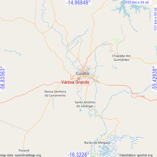
Várzea Grande GPS coordinates[2]
15° 38' 48.012" South, 56° 7' 57" West
| Map corner | latitude | longitude |
|---|---|---|
| Upper-left | -14.96849°, | -56.83563° |
| Center: | -15.64667°, | -56.1325° |
| Lower-right: | -16.3226°, | -55.42938° |
| Map W x H: | 150.6×150.6 km | = 93.6×93.6mi |
| max Lat: | 2.81972° ⇑45.5% North |
| Várzea Grande: | -15.64667° |
| min Lat: | ⇓54.5% South -33.69111° |
| min Long | Várzea Grande | max Long |
| -72.89583° | -56.1325° | -32.41083° |
| W 4.5%⇐ | ⇒95.5% E |
Elevation
Elevation of Várzea Grande is 197 m = 646 ft, and this is 183.9 m = 603 ft below average elevation for this country.
| Max E: |
1603 m = 5259 ft | 61.3% |
| Avg. | 380.9 m = 1250 ft | |
| Várzea Grande | 197 m = 646 ft | |
Min E: |
0 m = 0 ft | 38.7% |
See also: Várzea Grande elevation on elevation.city.
Geographical zone
Várzea Grande is located in South Torrid zone (between Equator and Tropic of Capricorn). Distance of this Southern Tropic circle is 866.2 km =538.2 mi to South.| Distance of | km | miles | from Várzea Grande |
|---|---|---|---|
| Equator | 1739.7 | 1081 | to North |
| Tropic Capricorn | 866.2 | 538.2 | to South |
| Antarctic Circle | 5661.4 | 3517.8 | to South |
| South Pole | 8267.3 | 5137.1 | to South |


Nearby cities:
15 places around Várzea Grande: (largest is in red/bold)
• Arenápolis
153.5 km =95.4 mi,  330°
330°
• Barra do Bugres
129.3 km =80.3 mi,  299°
299°
• Barão de Melgaço
63.4 km =39.4 mi,  163°
163°
• Chapada dos Guimarães
45.9 km =28.5 mi,  63°
63°
• Cuiabá
6.8 km =4.2 mi,  34°
34°
• Diamantino
141.7 km =88 mi,  346°
346°
• Jaciara
129.5 km =80.5 mi,  105°
105°
• Lucas
79.3 km =49.3 mi, 164°
• Nobres
105.1 km =65.3 mi, 348°
• Nortelândia
150.8 km =93.7 mi, 331°
• Nova Olímpia
155.9 km =96.9 mi,  307°
307°
• Poconé
85.7 km =53.3 mi,  217°
217°
• Rondonópolis
184.3 km =114.5 mi,  119°
119°
• Rosário Oeste
95.5 km =59.3 mi,  340°
340°
• Santo Antônio do Leverger
25.1 km =15.6 mi,  166°
166°
Sources, notices
• [Note1] Compared only with cities in Brazil existing in our database
• [Src1] Map data: © OpenStreetMap contributors (CC-BY-SA)
• [Src2] Other city data from geonames.org with taken over terms of usage.
• [Src3] Geographical zone / Annual Mean Temperature by Robert A. Rohde @ Wikipedia
