Corinto geodata
Corinto (Minas Gerais) is a populated place; located in Brazil in America/Sao_Paulo (GMT-3) time zone. With population of 22,121 people, there are 865 cities with bigger population in this country. Compared to other cities in Brazil, 51.5% of cities are located further ↑North; 53.4% of cities are located further ←West and 76.6% of cities have lower elevation than Corinto. Note1


Corinto GPS coordinates[2]
18° 22' 50.988" South, 44° 27' 23.004" West
| Map corner | latitude | longitude |
|---|---|---|
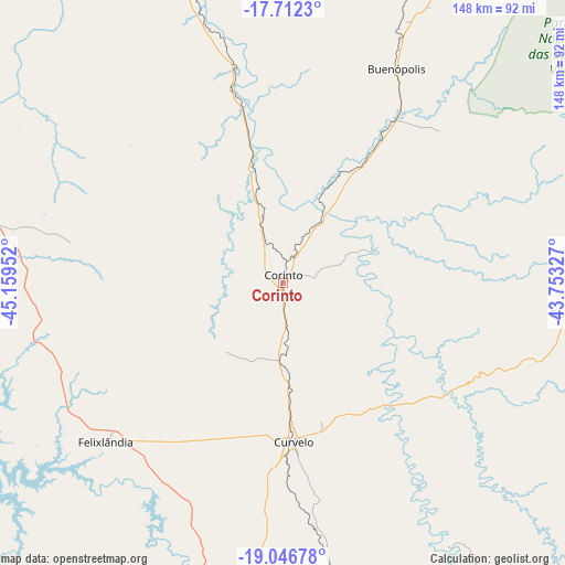
| Upper-left | -17.7123°, | -45.15952° |
| Center: | -18.38083°, | -44.45639° |
| Lower-right: | -19.04678°, | -43.75327° |
| Map W x H: | 148.4×148.4 km | = 92.2×92.2mi |
| max Lat: | 2.81972° ⇑51.5% North |
| Corinto: | -18.38083° |
| min Lat: | ⇓48.5% South -33.69111° |
| min Long | Corinto | max Long |
| -72.89583° | -44.45639° | -32.41083° |
| W 53.4%⇐ | ⇒46.6% E |
Elevation
Elevation of Corinto is 649 m = 2129 ft, and this is 268.1 m = 880 ft above average elevation for this country.
| Max E: |
1603 m = 5259 ft | 23.4% |
| Corinto | 649 m 2129 ft | |
| Avg. | 380.9 m = 1250 ft | |
Min E: |
0 m = 0 ft | 76.6% |
See also: Brazil elevation on elevation.city.
Geographical zone
Corinto is located in South Torrid zone (between Equator and Tropic of Capricorn). Distance of this Southern Tropic circle is 562.2 km =349.3 mi to South.| Distance of | km | miles | from Corinto |
|---|---|---|---|
| Equator | 2043.8 | 1270 | to North |
| Tropic Capricorn | 562.2 | 349.3 | to South |
| Antarctic Circle | 5357.4 | 3328.9 | to South |
| South Pole | 7963.3 | 4948.2 | to South |


Nearby cities:
15 places around Corinto: (largest is in red/bold)
• Abaeté
135.5 km =84.2 mi,  230°
230°
• Buritizeiro
126.4 km =78.5 mi,  334°
334°
• Conceição do Mato Dentro
130.9 km =81.3 mi,  123°
123°
• Curvelo
41.8 km =26 mi,  176°
176°
• Diamantina
91.3 km =56.7 mi,  80°
80°
• Martinho Campos
133.9 km =83.2 mi,  217°
217°
• Matozinhos
136.7 km =84.9 mi,  163°
163°
• Papagaios
122.7 km =76.2 mi,  194°
194°
• Pedro Leopoldo
144.3 km =89.7 mi, 162°
• Pirapora
126.1 km =78.4 mi,  335°
335°
• Pompéu
106.5 km =66.2 mi,  208°
208°
• Sabinópolis
148.1 km =92 mi,  102°
102°
• Serro
116.3 km =72.3 mi, 102°
• Sete Lagoas
122.6 km =76.2 mi,  169°
169°
• Várzea da Palma
91.9 km =57.1 mi, 341°
Sources, notices
• [Note1] Compared only with cities in Brazil existing in our database
• [Src1] Map data: © OpenStreetMap contributors (CC-BY-SA)
• [Src2] Other city data from geonames.org with taken over terms of usage.
• [Src3] Geographical zone / Annual Mean Temperature by Robert A. Rohde @ Wikipedia
