Chuí geodata
Chuí (Rio Grande do Sul) is a populated place; located in Brazil in America/Sao_Paulo (GMT-3) time zone. With population of 6,605 people, there are 1850 cities with bigger population in this country. Compared to other cities in Brazil, 100% of cities are located further ↑North; 91.4% of cities are located further →East and 88.9% of cities have higher elevation than Chuí. Note1


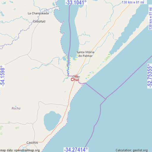
Chuí GPS coordinates[2]
33° 41' 27.996" South, 53° 27' 24.012" West
| Map corner | latitude | longitude |
|---|---|---|
| Upper-left | -33.1041°, | -54.1598° |
| Center: | -33.69111°, | -53.45667° |
| Lower-right: | -34.27414°, | -52.75355° |
| Map W x H: | 130.1×130.1 km | = 80.8×80.8mi |
| max Lat: | 2.81972° ⇑100% North |
| Chuí: | -33.69111° |
| min Lat: | ⇓0% South -33.69111° |
| min Long | Chuí | max Long |
| -72.89583° | -53.45667° | -32.41083° |
| W 8.6%⇐ | ⇒91.4% E |
Elevation
Elevation of Chuí is 20 m = 66 ft, and this is 360.9 m = 1184 ft below average elevation for this country.
| Max E: |
1603 m = 5259 ft | 88.9% |
| Avg. | 380.9 m = 1250 ft | |
| Chuí | 20 m = 66 ft | |
Min E: |
0 m = 0 ft | 11.1% |
See also: Brazil elevation on elevation.city.
Geographical zone
Chuí is located in South temperate zone (between Tropic of Capricorn and the Antarctic Circle). Distance of this Southern Tropic circle is 1140.2 km =708.5 mi to North.| Distance of | km | miles | from Chuí |
|---|---|---|---|
| Equator | 3746.1 | 2327.7 | to North |
| Tropic Capricorn | 1140.2 | 708.5 | to North |
| Antarctic Circle | 3655.1 | 2271.2 | to South |
| South Pole | 6261 | 3890.4 | to South |


Nearby cities:
15 places around Chuí: (largest is in red/bold)
• Arroio Grande
165.3 km =102.7 mi,  12°
12°
• Bagé
269.4 km =167.4 mi,  346°
346°
• Camaquã
351.6 km =218.5 mi,  26°
26°
• Canguçu
265.6 km =165 mi,  15°
15°
• Caçapava do Sul
353.2 km =219.5 mi,  359°
359°
• Dom Pedrito
322.1 km =200.1 mi,  339°
339°
• Encruzilhada do Sul
360.8 km =224.2 mi, 14°
• Herval
185.5 km =115.3 mi,  1°
1°
• Jaguarão
125.3 km =77.9 mi, 3°
• Pelotas
237.7 km =147.7 mi, 26°
• Pinheiro Machado
235 km =146 mi, 1°
• Rio Grande
223.6 km =138.9 mi, 34°
• Santa Vitória do Palmar
20.8 km =12.9 mi, 23°
• Santana do Livramento
367.4 km =228.3 mi,  327°
327°
• São Lourenço do Sul
293.4 km =182.3 mi, 28°
Sources, notices
• [Note1] Compared only with cities in Brazil existing in our database
• [Src1] Map data: © OpenStreetMap contributors (CC-BY-SA)
• [Src2] Other city data from geonames.org with taken over terms of usage.
• [Src3] Geographical zone / Annual Mean Temperature by Robert A. Rohde @ Wikipedia
