Águas Vermelhas geodata
Águas Vermelhas (Minas Gerais) is a populated place; located in Brazil in America/Sao_Paulo (GMT-3) time zone. With population of 16,409 people, there are 1128 cities with bigger population in this country. Compared to other cities in Brazil, 54.2% of cities are located further ↓South; 68.4% of cities are located further ←West and 83.1% of cities have lower elevation than Águas Vermelhas. Note1


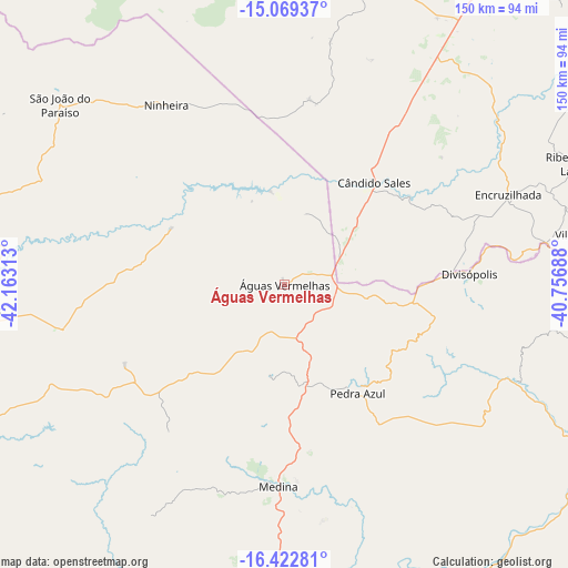
Águas Vermelhas GPS coordinates[2]
15° 44' 49.992" South, 41° 27' 36" West
| Map corner | latitude | longitude |
|---|---|---|
| Upper-left | -15.06937°, | -42.16313° |
| Center: | -15.74722°, | -41.46° |
| Lower-right: | -16.42281°, | -40.75688° |
| Map W x H: | 150.5×150.5 km | = 93.5×93.5mi |
| max Lat: | 2.81972° ⇑45.8% North |
| Águas Vermelhas: | -15.74722° |
| min Lat: | ⇓54.2% South -33.69111° |
| min Long | Águas Vermelha | max Long |
| -72.89583° | -41.46° | -32.41083° |
| W 68.4%⇐ | ⇒31.6% E |
Elevation
Elevation of Águas Vermelhas is 735 m = 2411 ft, and this is 354.1 m = 1162 ft above average elevation for this country.
| Max E: |
1603 m = 5259 ft | 16.9% |
| Águas Vermelhas | 735 m 2411 ft | |
| Avg. | 380.9 m = 1250 ft | |
Min E: |
0 m = 0 ft | 83.1% |
See also: Brazil elevation on elevation.city.
Geographical zone
Águas Vermelhas is located in South Torrid zone (between Equator and Tropic of Capricorn). Distance of this Southern Tropic circle is 855 km =531.3 mi to South.| Distance of | km | miles | from Águas Vermelhas |
|---|---|---|---|
| Equator | 1750.9 | 1088 | to North |
| Tropic Capricorn | 855 | 531.3 | to South |
| Antarctic Circle | 5650.2 | 3510.9 | to South |
| South Pole | 8256.1 | 5130.1 | to South |


Nearby cities:
15 places around Águas Vermelhas: (largest is in red/bold)
• Almenara
95.1 km =59.1 mi,  120°
120°
• Encruzilhada
63.6 km =39.5 mi,  67°
67°
• Itambé
105.5 km =65.6 mi,  58°
58°
• Itinga
101.6 km =63.1 mi,  198°
198°
• Jequitinhonha
90.6 km =56.3 mi,  147°
147°
• Joaíma
110.8 km =68.8 mi,  155°
155°
• Medina
52.9 km =32.9 mi,  181°
181°
• Pedra Azul
33.6 km =20.9 mi, 148°
• Rio Pardo de Minas
116.6 km =72.5 mi,  277°
277°
• Salinas
100.5 km =62.4 mi,  242°
242°
• São Felipe
101.3 km =62.9 mi,  4°
4°
• São João do Paraíso
76.5 km =47.5 mi,  309°
309°
• Taiobeiras
83 km =51.6 mi,  265°
265°
• Tremedal
85.9 km =53.4 mi, 3°
• Vitória da Conquista
118.4 km =73.6 mi,  34°
34°
Sources, notices
• [Note1] Compared only with cities in Brazil existing in our database
• [Src1] Map data: © OpenStreetMap contributors (CC-BY-SA)
• [Src2] Other city data from geonames.org with taken over terms of usage.
• [Src3] Geographical zone / Annual Mean Temperature by Robert A. Rohde @ Wikipedia
