Salinas geodata
Salinas (Minas Gerais) is a populated place; located in Brazil in America/Sao_Paulo (GMT-3) time zone. With population of 25,746 people, there are 765 cities with bigger population in this country. Compared to other cities in Brazil, 53.2% of cities are located further ↓South; 64.5% of cities are located further ←West and 59.9% of cities have lower elevation than Salinas. Note1


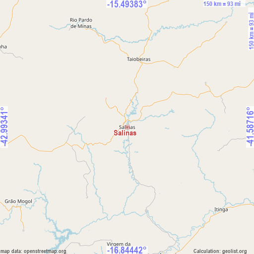
Salinas GPS coordinates[2]
16° 10' 13.008" South, 42° 17' 25.008" West
| Map corner | latitude | longitude |
|---|---|---|
| Upper-left | -15.49383°, | -42.99341° |
| Center: | -16.17028°, | -42.29028° |
| Lower-right: | -16.84442°, | -41.58716° |
| Map W x H: | 150.2×150.2 km | = 93.3×93.3mi |
| max Lat: | 2.81972° ⇑46.8% North |
| Salinas: | -16.17028° |
| min Lat: | ⇓53.2% South -33.69111° |
| min Long | Salinas | max Long |
| -72.89583° | -42.29028° | -32.41083° |
| W 64.5%⇐ | ⇒35.5% E |
Elevation
Elevation of Salinas is 472 m = 1549 ft, and this is 91.1 m = 299 ft above average elevation for this country.
| Max E: |
1603 m = 5259 ft | 40.1% |
| Salinas | 472 m 1549 ft | |
| Avg. | 380.9 m = 1250 ft | |
Min E: |
0 m = 0 ft | 59.9% |
See also: Brazil elevation on elevation.city.
Geographical zone
Salinas is located in South Torrid zone (between Equator and Tropic of Capricorn). Distance of this Southern Tropic circle is 808 km =502.1 mi to South.| Distance of | km | miles | from Salinas |
|---|---|---|---|
| Equator | 1798 | 1117.2 | to North |
| Tropic Capricorn | 808 | 502.1 | to South |
| Antarctic Circle | 5603.2 | 3481.7 | to South |
| South Pole | 8209.1 | 5100.9 | to South |


Nearby cities:
15 places around Salinas: (largest is in red/bold)
• Araçuaí
79.1 km =49.2 mi,  162°
162°
• Caraí
129.8 km =80.7 mi,  150°
150°
• Itinga
74.6 km =46.4 mi,  131°
131°
• Janaúba
116.3 km =72.3 mi,  290°
290°
• Mato Verde
105.8 km =65.7 mi,  324°
324°
• Medina
87 km =54.1 mi,  93°
93°
• Minas Novas
120.9 km =75.1 mi,  195°
195°
• Monte Azul
129.1 km =80.2 mi,  331°
331°
• Padre Paraíso
132.2 km =82.1 mi,  139°
139°
• Pedra Azul
107.7 km =66.9 mi,  80°
80°
• Porteirinha
92.1 km =57.2 mi,  301°
301°
• Rio Pardo de Minas
67.8 km =42.1 mi,  336°
336°
• São João do Paraíso
99.7 km =62 mi,  17°
17°
• Taiobeiras
40.8 km =25.4 mi,  8°
8°
• Águas Vermelhas
100.5 km =62.4 mi,  62°
62°
Sources, notices
• [Note1] Compared only with cities in Brazil existing in our database
• [Src1] Map data: © OpenStreetMap contributors (CC-BY-SA)
• [Src2] Other city data from geonames.org with taken over terms of usage.
• [Src3] Geographical zone / Annual Mean Temperature by Robert A. Rohde @ Wikipedia
