Jequitinhonha geodata
Jequitinhonha (Minas Gerais) is a populated place; located in Brazil in America/Sao_Paulo (GMT-3) time zone. With population of 15,463 people, there are 1193 cities with bigger population in this country. Compared to other cities in Brazil, 52.3% of cities are located further ↓South; 70.1% of cities are located further ←West and 57.6% of cities have higher elevation than Jequitinhonha. Note1


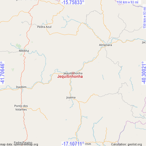
Jequitinhonha GPS coordinates[2]
16° 26' 2.004" South, 41° 0' 11.988" West
| Map corner | latitude | longitude |
|---|---|---|
| Upper-left | -15.75833°, | -41.70646° |
| Center: | -16.43389°, | -41.00333° |
| Lower-right: | -17.10711°, | -40.30021° |
| Map W x H: | 150×150 km | = 93.2×93.2mi |
| max Lat: | 2.81972° ⇑47.7% North |
| Jequitinhonha: | -16.43389° |
| min Lat: | ⇓52.3% South -33.69111° |
| min Long | Jequitinhonha | max Long |
| -72.89583° | -41.00333° | -32.41083° |
| W 70.1%⇐ | ⇒29.9% E |
Elevation
Elevation of Jequitinhonha is 239 m = 784 ft, and this is 141.9 m = 466 ft below average elevation for this country.
| Max E: |
1603 m = 5259 ft | 57.6% |
| Avg. | 380.9 m = 1250 ft | |
| Jequitinhonha | 239 m = 784 ft | |
Min E: |
0 m = 0 ft | 42.4% |
See also: Brazil elevation on elevation.city.
Geographical zone
Jequitinhonha is located in South Torrid zone (between Equator and Tropic of Capricorn). Distance of this Southern Tropic circle is 778.6 km =483.8 mi to South.| Distance of | km | miles | from Jequitinhonha |
|---|---|---|---|
| Equator | 1827.3 | 1135.4 | to North |
| Tropic Capricorn | 778.6 | 483.8 | to South |
| Antarctic Circle | 5573.9 | 3463.5 | to South |
| South Pole | 8179.8 | 5082.7 | to South |


Nearby cities:
15 places around Jequitinhonha: (largest is in red/bold)
• Almenara
43.1 km =26.8 mi,  49°
49°
• Araçuaí
122.7 km =76.2 mi,  247°
247°
• Caraí
111.6 km =69.3 mi,  221°
221°
• Encruzilhada
100.8 km =62.6 mi,  5°
5°
• Guaratinga
131.3 km =81.6 mi,  97°
97°
• Itanhém
108.5 km =67.4 mi,  138°
138°
• Itarantim
132.1 km =82.1 mi, 49°
• Itinga
83.6 km =51.9 mi,  256°
256°
• Joaíma
24.7 km =15.3 mi,  186°
186°
• Medeiros Neto
133.6 km =83 mi, 141°
• Medina
55.7 km =34.6 mi,  294°
294°
• Padre Paraíso
87.7 km =54.5 mi, 215°
• Pedra Azul
57.1 km =35.5 mi,  326°
326°
• Águas Formosas
72.4 km =45 mi,  174°
174°
• Águas Vermelhas
90.6 km =56.3 mi, 327°
Sources, notices
• [Note1] Compared only with cities in Brazil existing in our database
• [Src1] Map data: © OpenStreetMap contributors (CC-BY-SA)
• [Src2] Other city data from geonames.org with taken over terms of usage.
• [Src3] Geographical zone / Annual Mean Temperature by Robert A. Rohde @ Wikipedia
