Coari geodata
Coari (Amazonas) is a populated place; located in Brazil in America/Manaus (GMT-4) time zone. With population of 50,490 people, there are 426 cities with bigger population in this country. Compared to other cities in Brazil, 91.1% of cities are located further ↓South; 98.3% of cities are located further →East and 81% of cities have higher elevation than Coari. Note1


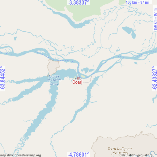
Coari GPS coordinates[2]
4° 5' 6" South, 63° 8' 29.004" West
| Map corner | latitude | longitude |
|---|---|---|
| Upper-left | -3.38337°, | -63.84452° |
| Center: | -4.085°, | -63.14139° |
| Lower-right: | -4.78601°, | -62.43827° |
| Map W x H: | 156×156 km | = 96.9×96.9mi |
| max Lat: | 2.81972° ⇑8.9% North |
| Coari: | -4.085° |
| min Lat: | ⇓91.1% South -33.69111° |
| min Long | Coari | max Long |
| -72.89583° | -63.14139° | -32.41083° |
| W 1.7%⇐ | ⇒98.3% E |
Elevation
Elevation of Coari is 42 m = 138 ft, and this is 338.9 m = 1112 ft below average elevation for this country.
| Max E: |
1603 m = 5259 ft | 81% |
| Avg. | 380.9 m = 1250 ft | |
| Coari | 42 m = 138 ft | |
Min E: |
0 m = 0 ft | 19% |
See also: Coari elevation on elevation.city.
Geographical zone
Coari is located in South Torrid zone (between Equator and Tropic of Capricorn). Distance of Equator is 454.2 km =282.2 mi to North.| Distance of | km | miles | from Coari |
|---|---|---|---|
| Equator | 454.2 | 282.2 | to North |
| Tropic Capricorn | 2151.7 | 1337 | to South |
| Antarctic Circle | 6947 | 4316.7 | to South |
| South Pole | 9552.9 | 5935.9 | to South |


Nearby cities:
15 places around Coari: (largest is in red/bold)
• Alvarães
208 km =129.2 mi,  297°
297°
• Anori
169.7 km =105.4 mi,  78°
78°
• Barcelos
346.8 km =215.5 mi,  3°
3°
• Canutama
305 km =189.5 mi,  206°
206°
• Codajás
123.4 km =76.7 mi, 77°
• Fonte Boa
371.2 km =230.7 mi, 298°
• Iranduba
339.8 km =211.1 mi,  74°
74°
• Manacapuru
293 km =182.1 mi, 72°
• Manaquiri
321.3 km =199.6 mi, 74°
• Manaus
362.7 km =225.4 mi, 72°
• Manicoré
279.9 km =173.9 mi,  133°
133°
• Maraã
351.9 km =218.7 mi,  315°
315°
• Novo Aripuanã
327 km =203.2 mi,  110°
110°
• Tefé
192.5 km =119.6 mi,  294°
294°
• Uarini
249.9 km =155.3 mi, 299°
Sources, notices
• [Note1] Compared only with cities in Brazil existing in our database
• [Src1] Map data: © OpenStreetMap contributors (CC-BY-SA)
• [Src2] Other city data from geonames.org with taken over terms of usage.
• [Src3] Geographical zone / Annual Mean Temperature by Robert A. Rohde @ Wikipedia
