Barcelos geodata
Barcelos (Amazonas) is a populated place; located in Brazil in America/Manaus (GMT-4) time zone. With population of 7,353 people, there are 1813 cities with bigger population in this country. Compared to other cities in Brazil, 99.2% of cities are located further ↓South; 98.1% of cities are located further →East and 83.5% of cities have higher elevation than Barcelos. Note1


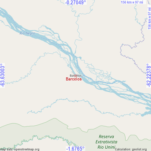
Barcelos GPS coordinates[2]
0° 58' 24.852" South, 62° 55' 36.84" West
| Map corner | latitude | longitude |
|---|---|---|
| Upper-left | -0.27049°, | -63.63003° |
| Center: | -0.97357°, | -62.9269° |
| Lower-right: | -1.6765°, | -62.22378° |
| Map W x H: | 156.3×156.3 km | = 97.1×97.1mi |
| max Lat: | 2.81972° ⇑0.8% North |
| Barcelos: | -0.97357° |
| min Lat: | ⇓99.2% South -33.69111° |
| min Long | Barcelos | max Long |
| -72.89583° | -62.9269° | -32.41083° |
| W 1.9%⇐ | ⇒98.1% E |
Elevation
Elevation of Barcelos is 35 m = 115 ft, and this is 345.9 m = 1135 ft below average elevation for this country.
| Max E: |
1603 m = 5259 ft | 83.5% |
| Avg. | 380.9 m = 1250 ft | |
| Barcelos | 35 m = 115 ft | |
Min E: |
0 m = 0 ft | 16.5% |
See also: Brazil elevation on elevation.city.
Geographical zone
Barcelos is located in South Torrid zone (between Equator and Tropic of Capricorn). Distance of Equator is 108.3 km =67.3 mi to North.| Distance of | km | miles | from Barcelos |
|---|---|---|---|
| Equator | 108.3 | 67.3 | to North |
| Tropic Capricorn | 2497.7 | 1552 | to South |
| Antarctic Circle | 7292.9 | 4531.6 | to South |
| South Pole | 9898.8 | 6150.8 | to South |


Nearby cities:
15 places around Barcelos: (largest is in red/bold)
• Alvarães
325.5 km =202.3 mi,  219°
219°
• Anori
342.3 km =212.7 mi,  155°
155°
• Careiro da Várzea
424 km =263.5 mi,  125°
125°
• Coari
346.8 km =215.5 mi,  183°
183°
• Codajás
332.7 km =206.7 mi, 163°
• Fonte Boa
391.2 km =243.1 mi,  244°
244°
• Iranduba
398.5 km =247.6 mi, 130°
• Manacapuru
364.1 km =226.2 mi,  135°
135°
• Manaquiri
387.1 km =240.5 mi, 132°
• Manaus
400 km =248.5 mi, 126°
• Maraã
286.4 km =178 mi,  250°
250°
• Rio Preto da Eva
406.5 km =252.6 mi,  118°
118°
• Santa Isabel do Rio Negro
240.8 km =149.6 mi,  284°
284°
• Tefé
332.6 km =206.7 mi, 216°
• Uarini
330.2 km =205.2 mi,  227°
227°
Sources, notices
• [Note1] Compared only with cities in Brazil existing in our database
• [Src1] Map data: © OpenStreetMap contributors (CC-BY-SA)
• [Src2] Other city data from geonames.org with taken over terms of usage.
• [Src3] Geographical zone / Annual Mean Temperature by Robert A. Rohde @ Wikipedia
