Pôsto Fiscal Rolim de Moura geodata
Pôsto Fiscal Rolim de Moura (Rondônia) is a populated place; located in Brazil in America/Porto_Velho (GMT-4) time zone. With population of 37,949 people, there are 549 cities with bigger population in this country. Compared to other cities in Brazil, 59.7% of cities are located further ↓South; 98% of cities are located further →East and 66% of cities have higher elevation than Pôsto Fiscal Rolim de Moura. Note1
Current local time in Pôsto Fiscal Rolim de Moura:
04:15 PM, TuesdayDifference from your time zone: hours


Pôsto Fiscal Rolim de Moura GPS coordinates[2]
13° 4' 57.756" South, 62° 16' 38.136" West
| Map corner | latitude | longitude |
|---|---|---|
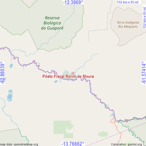
| Upper-left | -12.3969°, | -62.98039° |
| Center: | -13.08271°, | -62.27726° |
| Lower-right: | -13.76662°, | -61.57414° |
| Map W x H: | 152.3×152.3 km | = 94.6×94.6mi |
| max Lat: | 2.81972° ⇑40.3% North |
| Pôsto Fiscal Rolim de Moura: | -13.08271° |
| min Lat: | ⇓59.7% South -33.69111° |
| min Long | Pôsto Fiscal R | max Long |
| -72.89583° | -62.27726° | -32.41083° |
| W 2%⇐ | ⇒98% E |
Elevation
Elevation of Pôsto Fiscal Rolim de Moura is 159 m = 522 ft, and this is 221.9 m = 728 ft below average elevation for this country.
| Max E: |
1603 m = 5259 ft | 66% |
| Avg. | 380.9 m = 1250 ft | |
| Pôsto Fiscal Rolim de Moura | 159 m = 522 ft | |
Min E: |
0 m = 0 ft | 34% |
See also: Brazil elevation on elevation.city.
Geographical zone
Pôsto Fiscal Rolim de Moura is located in South Torrid zone (between Equator and Tropic of Capricorn). Distance of this Southern Tropic circle is 1151.3 km =715.4 mi to South.| Distance of | km | miles | from Pôsto Fiscal Rolim de Moura |
|---|---|---|---|
| Equator | 1454.7 | 903.9 | to North |
| Tropic Capricorn | 1151.3 | 715.4 | to South |
| Antarctic Circle | 5946.5 | 3695 | to South |
| South Pole | 8552.4 | 5314.2 | to South |


Nearby cities:
10 places around Pôsto Fiscal Rolim de Moura: (largest is in red/bold)
• Ariquemes
362.1 km =225 mi,  346°
346°
• Cacoal
203.8 km =126.6 mi,  26°
26°
• Guajará Mirim
419.6 km =260.7 mi,  307°
307°
• Jaru
294.7 km =183.1 mi,  355°
355°
• Ji Paraná
246.9 km =153.4 mi,  8°
8°
• Ouro Preto do Oeste
259.7 km =161.4 mi,  1°
1°
• Pimenta Bueno
196.1 km =121.9 mi,  36°
36°
• Pontes e Lacerda
396.7 km =246.5 mi,  126°
126°
• Presidente Médici
216 km =134.2 mi, 10°
• Vilhena
234.1 km =145.5 mi,  80°
80°
Sources, notices
• [Note1] Compared only with cities in Brazil existing in our database
• [Src1] Map data: © OpenStreetMap contributors (CC-BY-SA)
• [Src2] Other city data from geonames.org with taken over terms of usage.
• [Src3] Geographical zone / Annual Mean Temperature by Robert A. Rohde @ Wikipedia
