Ouro Preto do Oeste geodata
Ouro Preto do Oeste (Rondônia) is a populated place; located in Brazil in America/Porto_Velho (GMT-4) time zone. With population of 26,683 people, there are 743 cities with bigger population in this country. Compared to other cities in Brazil, 65.7% of cities are located further ↓South; 98% of cities are located further →East and 60% of cities have higher elevation than Ouro Preto do Oeste. Note1


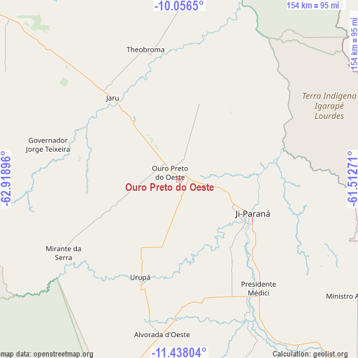
Ouro Preto do Oeste GPS coordinates[2]
10° 44' 53.016" South, 62° 12' 56.988" West
| Map corner | latitude | longitude |
|---|---|---|
| Upper-left | -10.0565°, | -62.91896° |
| Center: | -10.74806°, | -62.21583° |
| Lower-right: | -11.43804°, | -61.51271° |
| Map W x H: | 153.6×153.6 km | = 95.4×95.4mi |
| max Lat: | 2.81972° ⇑34.3% North |
| Ouro Preto do Oeste: | -10.74806° |
| min Lat: | ⇓65.7% South -33.69111° |
| min Long | Ouro Preto do O | max Long |
| -72.89583° | -62.21583° | -32.41083° |
| W 2%⇐ | ⇒98% E |
Elevation
Elevation of Ouro Preto do Oeste is 214 m = 702 ft, and this is 166.9 m = 548 ft below average elevation for this country.
| Max E: |
1603 m = 5259 ft | 60% |
| Avg. | 380.9 m = 1250 ft | |
| Ouro Preto do Oeste | 214 m = 702 ft | |
Min E: |
0 m = 0 ft | 40% |
See also: Brazil elevation on elevation.city.
Geographical zone
Ouro Preto do Oeste is located in South Torrid zone (between Equator and Tropic of Capricorn). Distance of Equator is 1195.1 km =742.6 mi to North.| Distance of | km | miles | from Ouro Preto do Oeste |
|---|---|---|---|
| Equator | 1195.1 | 742.6 | to North |
| Tropic Capricorn | 1410.8 | 876.6 | to South |
| Antarctic Circle | 6206.1 | 3856.3 | to South |
| South Pole | 8812 | 5475.5 | to South |


Nearby cities:
12 places around Ouro Preto do Oeste: (largest is in red/bold)
• Aripuanã
246.9 km =153.4 mi,  44°
44°
• Ariquemes
129.5 km =80.5 mi,  315°
315°
• Cacoal
113.7 km =70.6 mi,  132°
132°
• Guajará Mirim
340.8 km =211.8 mi,  269°
269°
• Humaitá
370.3 km =230.1 mi,  346°
346°
• Jaru
44 km =27.3 mi, 321°
• Ji Paraná
32.6 km =20.3 mi,  117°
117°
• Pimenta Bueno
151.6 km =94.2 mi, 132°
• Porto Velho
288.1 km =179 mi, 320°
• Presidente Médici
58.6 km =36.4 mi,  144°
144°
• Pôsto Fiscal Rolim de Moura
259.7 km =161.4 mi,  181°
181°
• Vilhena
316 km =196.4 mi, 134°
Sources, notices
• [Note1] Compared only with cities in Brazil existing in our database
• [Src1] Map data: © OpenStreetMap contributors (CC-BY-SA)
• [Src2] Other city data from geonames.org with taken over terms of usage.
• [Src3] Geographical zone / Annual Mean Temperature by Robert A. Rohde @ Wikipedia
