Presidente Médici geodata
Presidente Médici (Rondônia) is a populated place; located in Brazil in America/Porto_Velho (GMT-4) time zone. With population of 11,922 people, there are 1483 cities with bigger population in this country. Compared to other cities in Brazil, 64.5% of cities are located further ↓South; 97.8% of cities are located further →East and 63.4% of cities have higher elevation than Presidente Médici. Note1


Presidente Médici GPS coordinates[2]
11° 10' 31.008" South, 61° 54' 5.004" West
| Map corner | latitude | longitude |
|---|---|---|
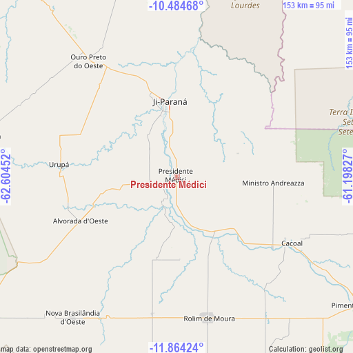
| Upper-left | -10.48468°, | -62.60452° |
| Center: | -11.17528°, | -61.90139° |
| Lower-right: | -11.86424°, | -61.19827° |
| Map W x H: | 153.4×153.4 km | = 95.3×95.3mi |
| max Lat: | 2.81972° ⇑35.5% North |
| Presidente Médici: | -11.17528° |
| min Lat: | ⇓64.5% South -33.69111° |
| min Long | Presidente Méd | max Long |
| -72.89583° | -61.90139° | -32.41083° |
| W 2.2%⇐ | ⇒97.8% E |
Elevation
Elevation of Presidente Médici is 181 m = 594 ft, and this is 199.9 m = 656 ft below average elevation for this country.
| Max E: |
1603 m = 5259 ft | 63.4% |
| Avg. | 380.9 m = 1250 ft | |
| Presidente Médici | 181 m = 594 ft | |
Min E: |
0 m = 0 ft | 36.6% |
See also: Brazil elevation on elevation.city.
Geographical zone
Presidente Médici is located in South Torrid zone (between Equator and Tropic of Capricorn). Distance of Equator is 1242.6 km =772.1 mi to North.| Distance of | km | miles | from Presidente Médici |
|---|---|---|---|
| Equator | 1242.6 | 772.1 | to North |
| Tropic Capricorn | 1363.3 | 847.1 | to South |
| Antarctic Circle | 6158.6 | 3826.8 | to South |
| South Pole | 8764.5 | 5446 | to South |


Nearby cities:
12 places around Presidente Médici: (largest is in red/bold)
• Aripuanã
262.9 km =163.4 mi,  31°
31°
• Ariquemes
187.6 km =116.6 mi,  318°
318°
• Cacoal
57.5 km =35.7 mi,  120°
120°
• Guajará Mirim
377.4 km =234.5 mi,  276°
276°
• Humaitá
425.3 km =264.3 mi,  343°
343°
• Jaru
102.5 km =63.7 mi, 322°
• Ji Paraná
32.7 km =20.3 mi,  350°
350°
• Ouro Preto do Oeste
58.6 km =36.4 mi, 324°
• Pimenta Bueno
94.9 km =59 mi,  125°
125°
• Porto Velho
346.5 km =215.3 mi, 320°
• Pôsto Fiscal Rolim de Moura
216 km =134.2 mi,  190°
190°
• Vilhena
258.4 km =160.6 mi, 132°
Sources, notices
• [Note1] Compared only with cities in Brazil existing in our database
• [Src1] Map data: © OpenStreetMap contributors (CC-BY-SA)
• [Src2] Other city data from geonames.org with taken over terms of usage.
• [Src3] Geographical zone / Annual Mean Temperature by Robert A. Rohde @ Wikipedia
