Channel-Port aux Basques geodata
Channel-Port aux Basques (Newfoundland and Labrador) is a populated place; located in Canada in America/St_Johns (GMT-2.5) time zone. With population of 4,220 people, there are 516 cities with bigger population in this country. Compared to other cities in Canada, 51.6% of cities are located further ↓South; 96.9% of cities are located further ←West and 99.7% of cities have higher elevation than Channel-Port aux Basques. Note1
Current local time in Channel-Port aux Basques:
10:39 AM, FridayDifference from your time zone: hours


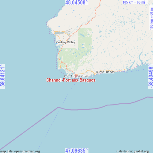
Channel-Port aux Basques GPS coordinates[2]
47° 34' 22.296" North, 59° 8' 17.088" West
| Map corner | latitude | longitude |
|---|---|---|
| Upper-left | 48.04508°, | -59.84121° |
| Center: | 47.57286°, | -59.13808° |
| Lower-right: | 47.09635°, | -58.43496° |
| Map W x H: | 105.5×105.5 km | = 65.6×65.6mi |
| max Lat: | 73.03752° ⇑48.4% North |
| Channel-Port aux Basques: | 47.57286° |
| min Lat: | ⇓51.6% South 42.05009° |
| min Long | Channel-Port au | max Long |
| -139.43328° | -59.13808° | -52.70931° |
| W 96.9%⇐ | ⇒3.1% E |
Elevation
Elevation of Channel-Port aux Basques is 1 m = 3 ft, and this is 253.4 m = 831 ft below average elevation for this country.
| Max E: |
1518 m = 4980 ft | 99.7% |
| Avg. | 254.4 m = 835 ft | |
| Channel-Port aux Basques | 1 m = 3 ft | |
Min E: |
-2 m = -7 ft | 0.3% |
See also: Canada elevation on elevation.city.
Geographical zone
Channel-Port aux Basques is located in North temperate zone (between Tropic of Cancer and the Arctic Circle). Distance of this North polar circle is 2111.6 km =1312.1 mi to North.| Distance of | km | miles | from Channel-Port aux Basques |
|---|---|---|---|
| North Pole | 4717.5 | 2931.3 | to North |
| Arctic Circle | 2111.6 | 1312.1 | to North |
| Tropic Cancer | 2683.7 | 1667.6 | to South |
| Equator | 5289.6 | 3286.8 | to South |


Nearby cities:
15 places around Channel-Port aux Basques: (largest is in red/bold)
• Bay St. George South
76.1 km =47.3 mi,  16°
16°
• Burgeo
114.3 km =71 mi,  87°
87°
• Corner Brook
176.5 km =109.7 mi,  29°
29°
• Deer Lake
217.5 km =135.1 mi,  35°
35°
• Eskasoni 3
213.1 km =132.4 mi,  211°
211°
• Glace Bay
165.2 km =102.7 mi,  202°
202°
• Grand Bank
259.5 km =161.2 mi,  101°
101°
• Harbour Breton
250.9 km =155.9 mi, 92°
• Pasadena
196.8 km =122.3 mi, 35°
• Princeville
259.8 km =161.4 mi,  219°
219°
• Souris
272.4 km =169.3 mi,  240°
240°
• Stephenville
116.2 km =72.2 mi, 20°
• Stephenville Crossing
115.7 km =71.9 mi, 26°
• Sydney
178.5 km =110.9 mi, 206°
• Sydney Mines
169.7 km =105.4 mi, 208°
Sources, notices
• [Note1] Compared only with cities in Canada existing in our database
• [Src1] Map data: © OpenStreetMap contributors (CC-BY-SA)
• [Src2] Other city data from geonames.org with taken over terms of usage.
• [Src3] Geographical zone / Annual Mean Temperature by Robert A. Rohde @ Wikipedia
