Stephenville geodata
Stephenville (Newfoundland and Labrador) is a populated place; located in Canada in America/St_Johns (GMT-2.5) time zone. With population of 6,278 people, there are 422 cities with bigger population in this country. Compared to other cities in Canada, 58.3% of cities are located further ↓South; 97.1% of cities are located further ←West and 90% of cities have higher elevation than Stephenville. Note1


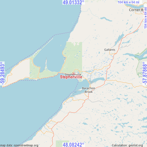
Stephenville GPS coordinates[2]
48° 33' 0.036" North, 58° 34' 54.48" West
| Map corner | latitude | longitude |
|---|---|---|
| Upper-left | 49.01332°, | -59.28493° |
| Center: | 48.55001°, | -58.5818° |
| Lower-right: | 48.08242°, | -57.87868° |
| Map W x H: | 103.5×103.5 km | = 64.3×64.3mi |
| max Lat: | 73.03752° ⇑41.7% North |
| Stephenville: | 48.55001° |
| min Lat: | ⇓58.3% South 42.05009° |
| min Long | Stephenville | max Long |
| -139.43328° | -58.5818° | -52.70931° |
| W 97.1%⇐ | ⇒2.9% E |
Elevation
Elevation of Stephenville is 15 m = 49 ft, and this is 239.4 m = 785 ft below average elevation for this country.
| Max E: |
1518 m = 4980 ft | 90% |
| Avg. | 254.4 m = 835 ft | |
| Stephenville | 15 m = 49 ft | |
Min E: |
-2 m = -7 ft | 10% |
See also: Canada elevation on elevation.city.
Geographical zone
Stephenville is located in North temperate zone (between Tropic of Cancer and the Arctic Circle). Distance of this North polar circle is 2002.9 km =1244.5 mi to North.| Distance of | km | miles | from Stephenville |
|---|---|---|---|
| North Pole | 4608.8 | 2863.8 | to North |
| Arctic Circle | 2002.9 | 1244.5 | to North |
| Tropic Cancer | 2792.3 | 1735.1 | to South |
| Equator | 5398.3 | 3354.3 | to South |


Nearby cities:
15 places around Stephenville: (largest is in red/bold)
• Bay St. George South
40.6 km =25.2 mi,  208°
208°
• Botwood
245.8 km =152.7 mi,  74°
74°
• Burgeo
126.2 km =78.4 mi,  145°
145°
• Channel-Port aux Basques
116.2 km =72.2 mi,  200°
200°
• Corner Brook
64.1 km =39.8 mi,  46°
46°
• Deer Lake
108.5 km =67.4 mi, 50°
• Glace Bay
281.4 km =174.9 mi, 201°
• Grand Bank
264.9 km =164.6 mi,  127°
127°
• Grand Falls-Windsor
218.1 km =135.5 mi,  78°
78°
• Harbour Breton
238.6 km =148.3 mi,  119°
119°
• La Scie
266.7 km =165.7 mi, 54°
• Lewisporte
269.7 km =167.6 mi, 73°
• Pasadena
88.8 km =55.2 mi, 54°
• Springdale
211.7 km =131.5 mi,  60°
60°
• Stephenville Crossing
12.4 km =7.7 mi, 116°
Sources, notices
• [Note1] Compared only with cities in Canada existing in our database
• [Src1] Map data: © OpenStreetMap contributors (CC-BY-SA)
• [Src2] Other city data from geonames.org with taken over terms of usage.
• [Src3] Geographical zone / Annual Mean Temperature by Robert A. Rohde @ Wikipedia
